Check out our Holiday Auction - Sign Up for the Utah Snow and Avalanche Workshop (USAW)

Observation: Snake Creek

Observation Date
12/23/2023
Observer Name
B
Region
Provo » Snake Creek
Location Name or Route
Snake Creek Drainage
Weather
Sky
Broken
Precipitation
Light Snowfall
Wind Direction
Northwest
Wind Speed
Moderate
Weather Comments
OVC shifting to BKN mid day and then OVC after 1600. Sustained period of S3 from 0600 to 1000 hours, with another period of S2 beginning around 1600 hours. HN: 10cm to 15cm. Moderate WNW Winds with Moderate Wind Blown.
Snow Characteristics
New Snow Depth
5"
New Snow Density
Low
Snow Surface Conditions
Powder
Wind Crust
Melt-Freeze Crust
Snow Characteristics Comments
Excellent mid winter powder riding on the Polars in the new snow from today combined with the 7cm from 20231220. Areas of Wind Blown/Sastrugi and firm Wind Slab on exposed ridgelines. Solars still very scratchy and slick. Trail Breaking on the Polars very slippery in the facets that were buried and preserved after getting covered by the 20231220 event.
Red Flags
Red Flags
Recent Avalanches
Cracking
Poor Snowpack Structure
Red Flags Comments
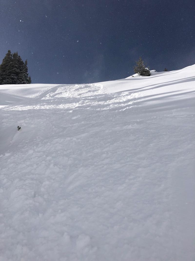
Very reactive/Touchy Loose Dry Avalanches that were easily triggered on the Polars in steep terrain; and these were running fast and far and entraining significant amounts of snow upon descent. These avalanches were easily dealt with, yet they were digging down at least 25cm into the old buried surface facets that were covered by the 20231220 event. (See photo) Cracking was observed in several areas that had Wind Slab development that ranged from 25 to 35cm deep. Poor Snowpack Structure continues to be widespread and unreactive on the Polars and Sudden Results were observed at 9750', HS: 95cm, NNW, 33 degrees (CTM SC) at 35cm up; 3mm Advanced Facets were the weak layer and the shear was at the top of a 4F minus layer of uncohesive facets that went down from the 35cm layer of concern to 10cm up.
Avalanche Problem #1
Problem
Persistent Weak Layer
Trend
Same
Problem #1 Comments
See above with the recently buried NSF layer as described previously as the most reactive PWL. Poor Structure as described above continues to be unreacttive, yet a layer of concern with any new significant sudden loading.
Avalanche Problem #2
Problem
New Snow
Trend
Increasing Danger
Problem #2 Comments
See above with regard to Loose Dry Issues.
See above with regard to Wind Slab Issues. Upper elevation winds appear to be continuing in the Moderate to Strong category.
Today's Observed Danger Rating
Moderate
Tomorrows Estimated Danger Rating
Moderate