Observation Date
12/17/2023
Observer Name
Derek DeBruin
Region
Ogden » Ben Lomond » Cutler Ridge
Location Name or Route
Ben Lomond, Cutler Ridge
Comments
Below about 7000ft, there's about 10-15cm of soft surface snow underlaid by a stout 10-15cm supportable crust. Beneath this is 4F/F snow to the bare dirt. HS grows from 50-60cm down low to about a meter by 7000ft.
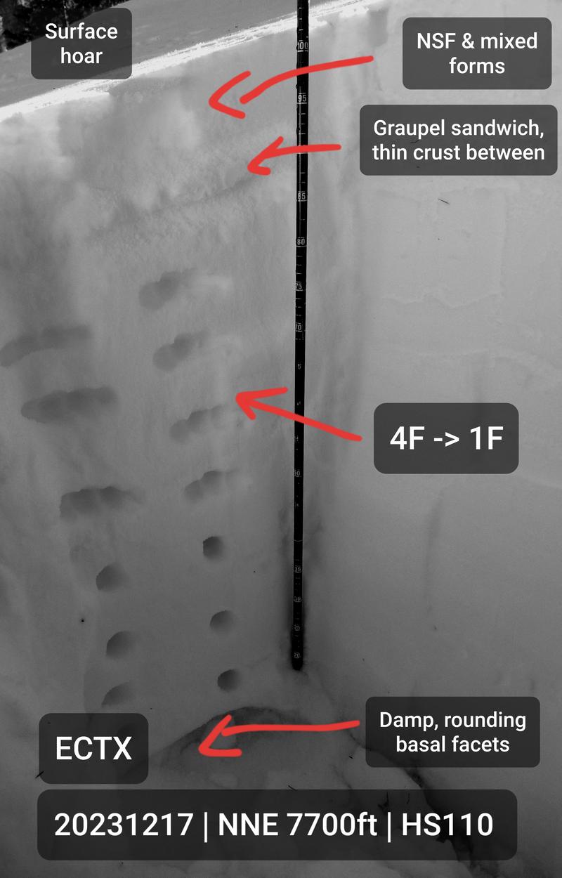
Above 7000ft, the subsurface crust deteriorates in earnest, only 2-3cm thick by 7500ft, and crumbly and unsupportive by 7800ft. The crust has graupel stripes immediately above and below. Underneath this is about 75cm of 4F to 1F right side up, stacked on the basal facets--about 10cm in my pit at 7700ft, but likely a bit thicker layer higher up based on what I saw a week ago.
Basal facets are rounding and fairly damp, with a single ECTX (non-)result.
At the moment, I think surface conditions pose a greater hazard than avalanches in many areas. However, I'm not excited to see so much surface hoar, the crust, nor the remnant graupel (to say nothing of basal facets) all waiting for the next snow.
I also noted a handful of old small D1 wet loose avalanches coming off the rocks on the solar aspects of Black Canyon, but they did not look recent.

Today's Observed Danger Rating
None
Tomorrows Estimated Danger Rating
None


