Check out our Holiday Auction - Sign Up for the Utah Snow and Avalanche Workshop (USAW)

Observation: Mineral Fork

Observation Date
12/14/2023
Observer Name
Gagne/Pease
Region
Salt Lake » Big Cottonwood Canyon » Mineral Fork
Location Name or Route
Mineral Fork
Weather
Sky
Clear
Snow Characteristics
Snow Surface Conditions
Dense Loose
Wind Crust
Melt-Freeze Crust
Snow Characteristics Comments
Some wind damage from recent wind event - we were finding this on north aspects with some cross-loading on east aspects. Plenty of weak snow at the surface - facets and surface hoar in drainage bottoms. Not a problem until it snows again or there is another wind event that may deposit wind drifts on top of weak facets at the snow surface.
HS (height of snow) is 60-90 cms and the snowpack is currently supportable allowing for easy travel.
Red Flags
Red Flags
Poor Snowpack Structure
Avalanche Problem #1
Problem
Persistent Weak Layer
Trend
Decreasing Danger
Problem #1 Comments
Poor snowpack structure remains, but likelihood of triggering an avalanche failing on the PWL is low. More thoughts on this layer in comments below.
Comments
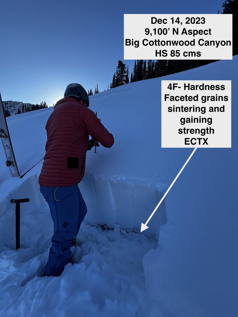
The PWL continues to gain strength with this layer in the bottom 15-30 cms of the snowpack at 4F- hardness and showing signs of sintering (bonding). ECTs this week have been ECTX (no fracture of the weak layer).
I will continue to assess slopes where the PWL is present (W/N/E) and avoid slopes where there is a thinner snowpack.
It is also important to note the PWL problem is currently dormant and hasn't gone away. When we get an additional load of snow (from snowfall and/or wind), the buried PWL and other weaknesses at the snow surface are likely to be reactive once again.
Today's Observed Danger Rating
Moderate
Tomorrows Estimated Danger Rating
Low
Coordinates