Check out our Holiday Auction

Forecast for the Moab Area Mountains

Eric Trenbeath
Issued by Eric Trenbeath on
Monday morning, April 24, 2023
We're through issuing regular avalanche forecasts for the season but we'll post condition updates as warranted through the month. I will also continue to post recent observations. Your primary concerns in the spring are loose wet avalanches from daytime heating. Consecutive nights without a freeze can increase the likelihood for more dangerous wet slab avalanches. Plan to get in and out early before slopes become wet and sloppy. Use the weather links below to aid in your trip planning.
Low
Moderate
Considerable
High
Extreme
Learn how to read the forecast here
Special Announcements
I would like to give a huge shout out to all who supported operations this season. This includes everyone who regularly used the forecast to stay safe; our local business sponsors Moab Gear Trader, Talking Mountain Yurts; Mammut, Black Diamond Equipment, Voile, and Arva for setting us up with the gear we need to do our job; the Manti-La Sal National Forest for their tremendous support of this program; and last but not least, our great local community and crew of dedicated observers who provide vital information and assistance throughout the season. Thanks everyone, see you next winter!
Weather and Snow
Snowpack and Weather Data
Gold Basin Storm Stake (10,000')
Gold Basin SNOTEL site (10,000')
SNOTEL site near Geyser Pass Winter Trailhead (9600')
Wind Station on Pre-Laurel Peak (11,400')
NWS forecast for the La Sal Mountains.

General Conditions
Spring conditions have yet to take full control. Corn snow has developed on southerly aspects while north facing slopes remain a variable mix of wind affected, dryish, transitional snow. There is also a fair amount of dust on the surface that will become more concentrated as the snow melts. Most of the dust is on south facing slopes near treeline and below and it has really settled into sheltered, low angle terrain. The good news is that north facing slopes are still mostly white and when they finally turn the corner, we stand a chance for good skiing well into May. Cloudy and windy weather won't make for the best conditions Mon-Tue, but sunny, warm days and cold clear nights should make for good corn skiing and riding later in the week.
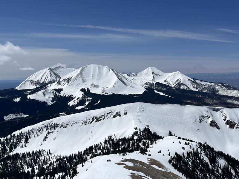
Looking south to the high peaks surrounding Gold Basin. From left to right: Mounts Peale; Mellenthin, Tukuhnikivatz; Tukno. Still plenty of snow up there! (April 23)
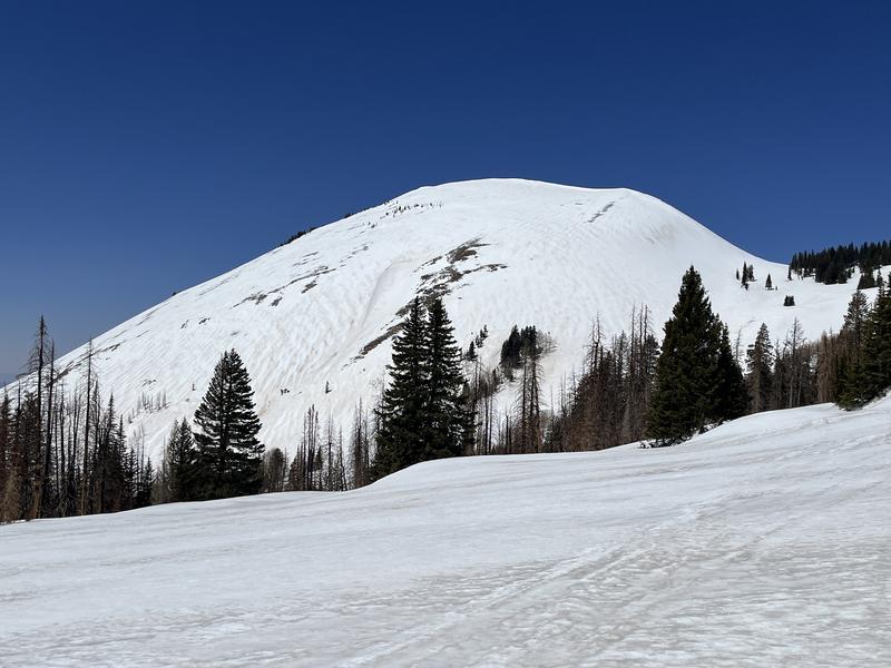
E-SE face of Haystack Mountain. Definitely some dust up there. (April 23)
Recent Avalanches
Ad
Avalanche Problem #1
Normal Caution
Type
Location
Likelihood
Size
Description
Spring Time Avalanche Concerns
Timing is everything this time of year. Get in early and out early, both for the best snow conditions and to avoid the threat of loose, wet avalanches. Follow the sun and ride slopes with an easterly aspect first, then move to south, and finally west. Signs of instability include rollerballs, pinwheels, and sloppy wet snow. If you find yourself sinking into wet snow above your ankles, you're out too late.
Loose Wet Avalanches are the most common springtime avalanche hazard as a strong sun and warm temps melt and soften the snow surface. Signs of instability include rollerballs, pinwheels, and "point release" sluffs that fan out and gather more snow as they travel down the slope. Timing is everything this time of year. Work slopes according to their aspect in relation to the sun and get off of steep slopes as they become wet and sloppy.
Wet Slabs release when melt water saturates a layer in the snowpack and the over riding slab fails as a cohesive layer. These avalanches are harder to predict than loose wet, and outward signs of this problem are not obvious, but sloppy, wet, or punchy snow indicate that the pack is trending towards unstable. Successive nights without a freeze and warm daytime temps contribute to instability. Avoid thin shallow rocky areas and terrain under cliffs, especially if the snow is becoming wet and sloppy.
Cornices are huge this year. Give them a wide berth. Daytime hearting makes them particualrly susceptible to breaking off this time of year.
New Snow can cause the avalanche danger to rise just like in the winter. Poorly bonded new snow can cause problems on all aspects when there is more than about 6" of new snow. Loose snow sluffs and soft slab avalanches are possible. This type of instability typically settles out in a day or two.
Wind Drifted Snow can create unstable drifts or slabs on the leeward sides of ridge crests and terrain features. Recent wind drifts are recognizable by their smooth, rounded appearance and cracking is a sign of instability. Unstable wind drifts can linger for days or even up to a week.
Additional Information
That's all folks!
General Announcements
This forecast is from the U.S.D.A. Forest Service, which is solely responsible for its content. This forecast describes general avalanche conditions and local variations always occur.