Observation Date
4/20/2023
Observer Name
Gagne
Region
Salt Lake » Little Cottonwood Canyon » Catherine's Pass
Location Name or Route
Catherine's Pass Area
Comments
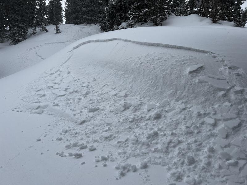
I found similar conditions to what Jen S also saw in the Catherine's Area: lots of cracking and plenty of small avalanches that were easy to trigger, especially in any areas with wind-loading. These avalanches were all small (Class 1) and only 10-15 cms thick and broke at most a few meters wide. The weak layer was the few cms of snow that fell overnight Tuesday into Wednesday morning, just on top of a thin dust layer.
Although these avalanches were small, it did give me an idea of what to expect with more snowfall and wind forecast overnight and into Friday. With such smooth snow surfaces, avalanches may run far.
Photos of a few small avalanches I was able to easily trigger during periods of higher PI (precipitation intensity) and/or wind-drifting.

Today's Observed Danger Rating
Low
Tomorrows Estimated Danger Rating
Moderate
Coordinates


