Check out our Holiday Auction - Sign Up for the Utah Snow and Avalanche Workshop (USAW)

Observation: Parleys Canyon

Observation Date
4/1/2023
Observer Name
Zimmerman-Wall/Matthews
Region
Salt Lake » Parleys Canyon
Location Name or Route
Parley's Burn
Weather
Sky
Overcast
Wind Direction
Southwest
Wind Speed
Light
Weather Comments
Started at 0800 with SCT clouds and trended to -OVC by 11am. Greenhousing noted mid day. Winds were light in our terrain, yet they remained elevated moderate to strong above 9000' as visible plumes of snow were transporting off of Grandview and Gobblers.
Snow Characteristics
New Snow Depth
12"
New Snow Density
Medium
Snow Surface Conditions
Powder
Damp
Snow Characteristics Comments
The promise of quality powder skiing seemed dashed by some previous reports, however the overnight radiational cooling and settlement in the new snow improved turning conditions immensly. Ski quality was Good to Very Good on the first run in the Burn (North facing). By mid day however, the high thin clouds trapped the outgoing radiation and the snowpack took a serious hit. Snow became damp on even sheltered steep northerly slopes. The lowers exiting back to Lambs TH were manageable but very dense and turning was diffiuclt among the tight patches of scrub oak.
Red Flags
Red Flags
Recent Avalanches
Heavy Snowfall
Wind Loading
Rapid Warming
Poor Snowpack Structure
Red Flags Comments
These red flags were observed over the course of the tour. The recent avalanches were less than 24hrs old.
Avalanche Problem #1
Problem
New Snow
Trend
Same
Problem #1 Comments
Primary concern was how the new snow was bonding to the old snow surface, which was a dirty Melt Freeze crust.
Avalanche Problem #2
Problem
Wet Snow
Trend
Same
Problem #2 Comments
As advertised, the warming temps pushed this problem into our mix, particularly with the greenhousing that took place mid day.
Comments
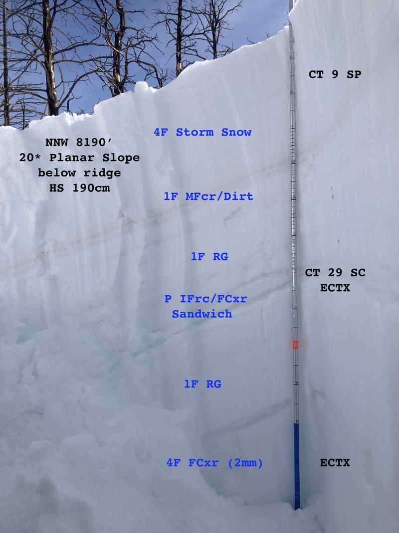
Two profiles (7600' and 8150' Northerly facing) showed similar structure in the upper snowpack. Photo 1.
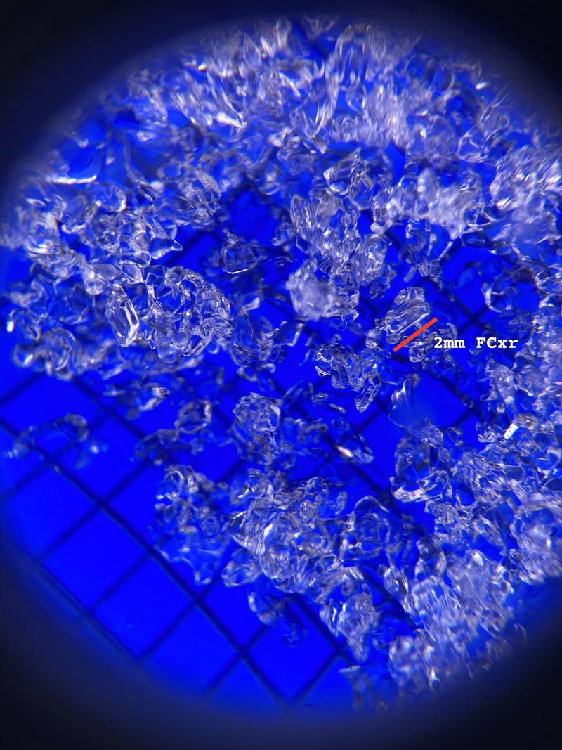
The most interesting thing was the dry and coarse grained rounding facets found in the bottom third of the snowpack. Photo 2 shows these 2mm factets. No failure initiation or propogation on this layer which was 120cm down.
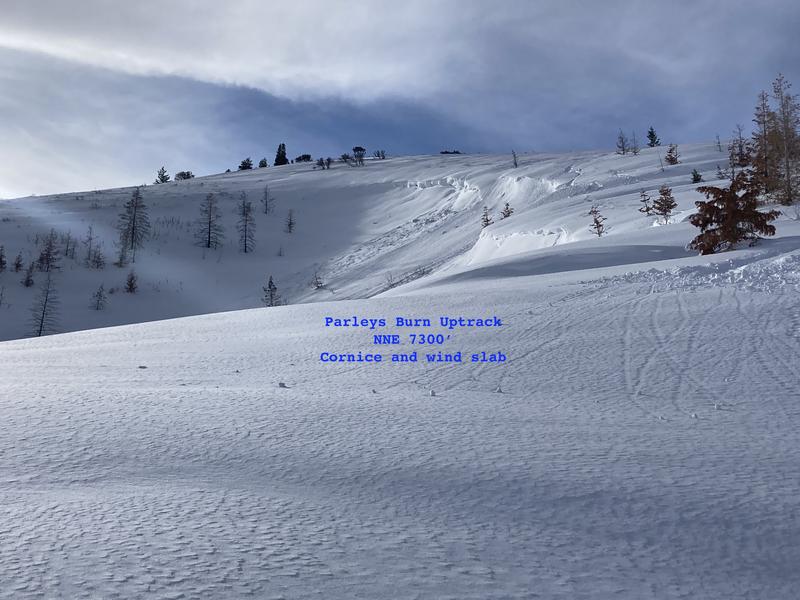
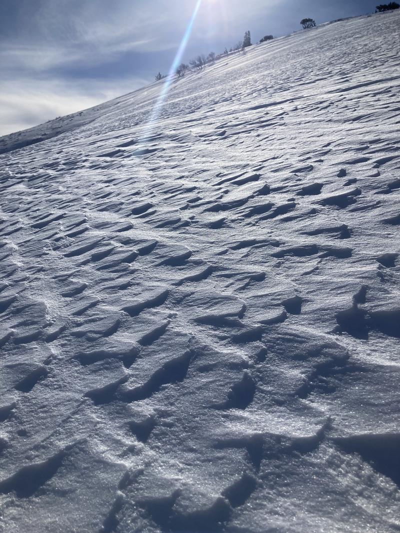
We did see a small cornice collapse and resulting small wind windslab avalanche from the previous 24 hour period that had failed in a crossloaded terrain feature. Photo 3 illustrates this failure, and Photo 4 shows the fetch that was highly wind textured. Loading right to left in the image.
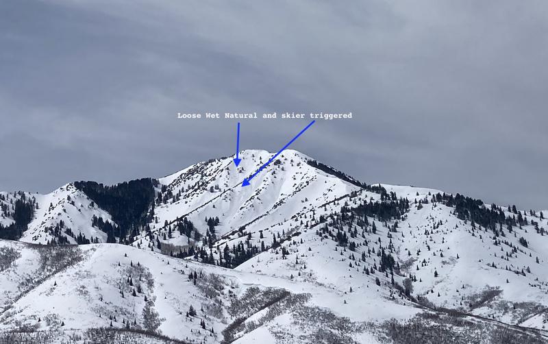
By the end of the tour at 1300 hrs visible loose wet avalnaches on steep East facing slopes of Mt. Aire could be seen, both natural and human triggered. Image 5.
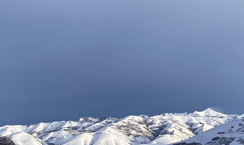
Throughout the day, SW winds remained elevated along the highest peaks in the area and there was a near constant plume of snow blowing off of Grandview peak to our north. Image 6.
Overall this terrain is still holding HS up to 250cm in some favored locations. It is becoming more popular and many individuals and other groups were noted in the area. No signs of rider triggered slab avalanches in the terrain observed.
Today's Observed Danger Rating
Moderate
Tomorrows Estimated Danger Rating
None
Coordinates