Join us at our 2nd Annual Blizzard Ball

Observation: Yellow Jacket

Observation Date
3/12/2023
Observer Name
Gagne/Kapacinskas
Region
Salt Lake » Mill Creek Canyon » Yellow Jacket
Location Name or Route
Gobblers - Yellowjacket
Weather
Sky
Obscured
Precipitation
Light Snowfall
Wind Direction
West
Wind Speed
Moderate
Weather Comments
Moderate gusts out of the west in exposed locations. Periods of light snowfall.
Snow Characteristics
New Snow Depth
4"
New Snow Density
Medium
Snow Surface Conditions
Powder
Snow Characteristics Comments
The top 5-15 cms of the snow surface consists of dense graupel and rimed stellars. Some greenhousing meant for damp snow at low elevations by noon.
Avalanche Problem #1
Problem
Wind Drifted Snow
Trend
Decreasing Danger
Problem #1 Comments
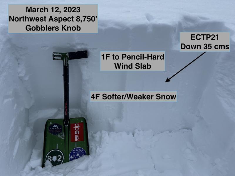
We focused field work on areas with recent wind-drifted snow. On a northwest aspect at 8,700', there was a dense 30-45 cm slab of strong, 1F-Pencil hard wind0-drifted snow underneath the recent storm snow from the past few days. This wind drift likely formed during Friday's strong wind event. ECTP21 failing down 35 cms on a layer of softer, 4F snow underneath the wind slab. We repeated the ECT - as well as a few compression tests - and got repeated failures in the weaker layer at 21 taps.
Although the softer snow is not a persistent weak layer and therefore it should gain strength fairly soon, we kept our travel to lower-angled slopes given this structure of strong over weak, recent avalanching in wind-drifted snow, and full propagation with extended column tests.
Comments
Photo showing snowpack structure of strong, wind-drifted snow over softwer/weaker snow.
Today's Observed Danger Rating
Moderate
Tomorrows Estimated Danger Rating
Moderate
Coordinates