Observation Date
1/30/2023
Observer Name
W Ambler
Region
Salt Lake » Little Cottonwood Canyon » Superior
Location Name or Route
Superior
Weather
Sky
Few
Wind Direction
West
Wind Speed
Light
Weather Comments
Very mild winds even at the summit of Superior. We noticed some airborne snow off white baldy and AF twins on our way up earlier this morning.
Snow Characteristics
Snow Surface Conditions
Powder
Dense Loose
Wind Crust
Damp
Snow Characteristics Comments
About halfway down superiors south face the snow surface got heavy ~11 AM. The Riding conditions were still enjoyable after we got the ice and glop off the bottoms of our skis. The upper half of the run was phenomenal. I expect a crust tomorrow
Red Flags
Red Flags
Recent Avalanches
Wind Loading
Rapid Warming
Red Flags Comments
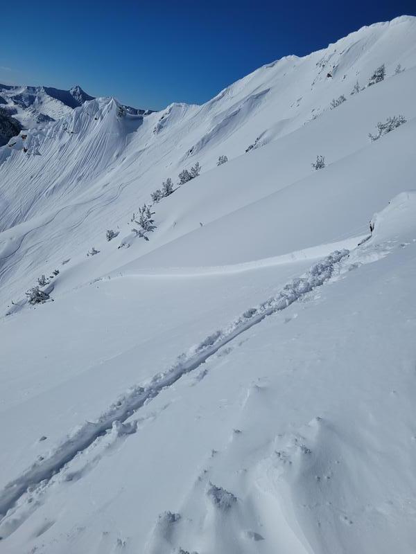
The temps felt warmer than anticipated, at least on the on the lower mountain, and the sun was very intense all morning. We noticed numerous natural slides which came down in the past few days. There was a wind slab which looked to have been triggered by a party earlier this morning a little ways east of the summit, which I expect will be reported. With the warming snow and intense sun we didn't notice any wet action as of 1 PM.
Avalanche Problem #1
Problem
Wind Drifted Snow
Trend
Same
Problem #1 Comments
There were obvious signs of wind drifted snow and recent avalanches on wind loaded slopes within the new snow and at the sun crust. SW-SE. We encountered punchy wind crusts on the ridge and large cornices and pillows.
Comments
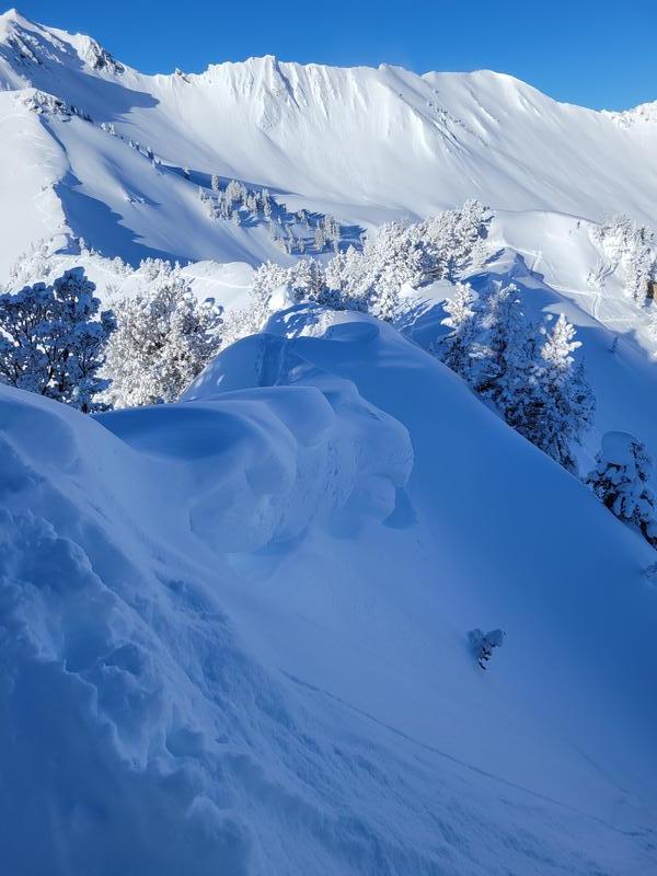
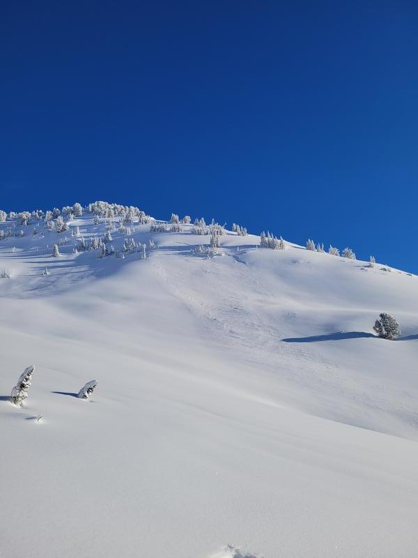
Pictured below is the aforementioned slide near the summit and below that are some cornices lower on the ridge, just past Cardiff peak. Lastly an older slide in Toledo Bowl.
Today's Observed Danger Rating
Considerable
Tomorrows Estimated Danger Rating
Moderate
Coordinates