Observation Date
1/28/2023
Observer Name
Paradis / Brackelsberg / Caplis
Region
Uintas » Upper Weber Canyon
Location Name or Route
Upper Weber Canyon
Weather
Sky
Broken
Precipitation
Light Snowfall
Wind Direction
North
Wind Speed
Moderate
Weather Comments
Generally light snow all most of the day. Some breaks in cloud cover. The most notable item was the winds. Strong winds were blowing up Smith Morehouse from the north, which created odd crossloading patterns in the snow.. As you traveled a little higher out of the valley bottom, the wind was less strong. Then as you would typically expect, winds were strong a ridge top.
Snow Characteristics
New Snow Depth
12"
New Snow Density
Medium
Snow Surface Conditions
Powder
Snow Characteristics Comments
Wind made a big difference in snow quality. In wind sheltered areas, snow was nice low density powder. There had also been a good bit of accumulation over the prior week from consistent light snow in N/NW flow. Lower, towards the valley bottom strong winds created dense and variable drifts that made skiing less consistent.
Red Flags
Red Flags
Wind Loading
Red Flags Comments
Wind was the most obvious issue today.
Avalanche Problem #1
Problem
Wind Drifted Snow
Trend
Increasing Danger
Problem #1 Comments
This observation is primarily to note that odd up-canyon winds were cross-loading slopes. So much snow was being transported that our skin track was filled between runs due to wind transport. Although this is something that could catch you by surprise, ski cuts didn't really produce much in the way of results. This may change with more snow forecast.
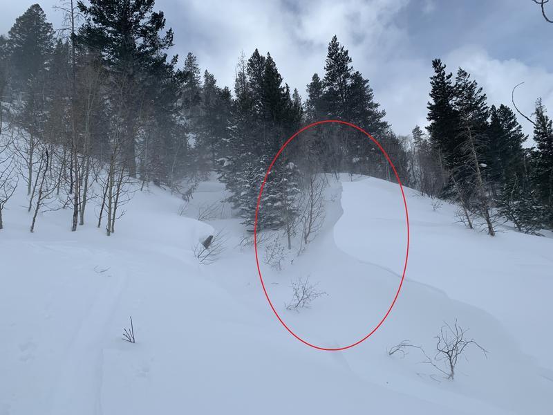
Photo above is an example of cross-loading well down into the trees, near the valley bottom. It doesn't show in the photo very well but the wind was transporting quite a bit of snow here.
Today's Observed Danger Rating
Moderate
Tomorrows Estimated Danger Rating
Considerable


