Observation: Cardiff Pass

Observation Date
1/27/2023
Observer Name
Zimmerman-Wall
Region
Salt Lake » Little Cottonwood Canyon » Cardiff Pass
Location Name or Route
Cardiff Pass
Weather
Sky
Overcast
Precipitation
Moderate Snowfall
Wind Direction
Northwest
Wind Speed
Moderate
Weather Comments
Overcast all day, and increasing mid and upper elevation cloud throughout the morning, some lifting of the cloud deck mid day, and then in and out the rest of the afternoon.Visibility was reduced to 10 feet at times. Snowfall picked up around 2pm as forecast, with rates varying from S1-S5 as squalls passed through. Accumulation was hard to assess due to wind and visibility. Winds were variable in the Cardiff bowl and on the pass due to terrain channeling. Noted wind directions of W-N-NE and variable speeds from moderate to strong. Temperature was warmer than yesterday but still below freezing.
Snow Characteristics
New Snow Depth
4"
New Snow Density
Medium
Snow Surface Conditions
Powder
Wind Crust
Melt-Freeze Crust
Snow Characteristics Comments
Generally the surface conditions were excellent, wind pressed snow and settled powder. We did note a buried variable thickness melt freeze crust down 10-20cm on slopes steeper than 35 with S-SW orientation. The new snow was bonded well to this layer and it was varied across the terrain. In a few locations this crust was present on the surface on wind stripped features.
Red Flags
Red Flags
Wind Loading
Avalanche Problem #1
Problem
Wind Drifted Snow
Trend
Increasing Danger
Problem #1 Comments
Fortunately, the extreme wind speeds in the AM forecast did not materialize at the locations visited. Strong gust were experienced along 10K ridge. Moderate wind transport at upper elevations throughout day, loading lee features but we did not observe much sensitivity in the new drifts, even along leeward terrain features. Saltation of surface snow was evident. Nothing beyond localized cracks underfoot in isolated areas. With the continued snowfall and wind during the late afternoon, coupled with the updated forecast, this problems' distribution and sensitivity will increase in the upper elevations, and may reach down into the middle elevations.
Comments
Height of snow was relatively consistent with upwards of 200-250cm found in most locations. Snowpack is right side up trending from 4F to 1F to Pencil hardness. Did not dig below 125cm deep. Compression tests across the terrain produced mostly CTX or CTH Breaks. In one wind effected locations at 9700' on a southerly slope, we had a few sudden fractures in the upper 30 cm on a nearly indiscernible hardness change, yet it did not propagate in ECT.
A few growing cornices were present in the mid-drainage small bowl feature along the skin track as you follow the power lines. The broad open fetch on the west side of this feature holds a lot of snow and the dramatic change in slope angle on the lee side promotes this growth. These were the largest we had seen this season and were overhanging the bowl below, which would be steep enough to slide and is somewhat of a terrain trap due to the abrupt transition at the bottom. These would be hard to see in the low visibility on a descent route from the pass.
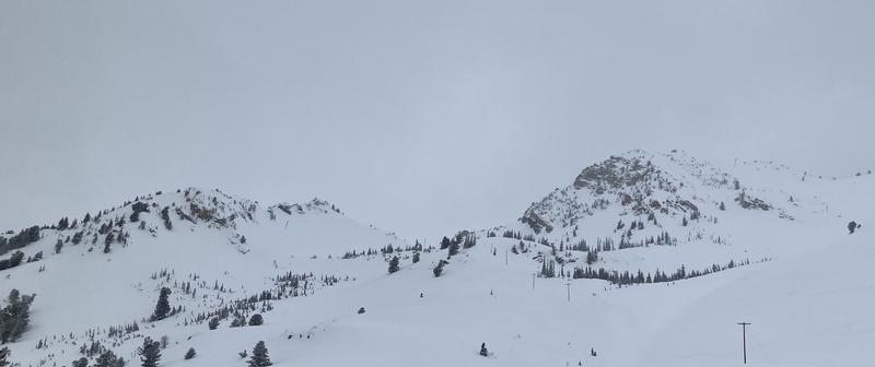
Photo of best visibility around 1245pm. Deteriorating through rest of afternoon.
Today's Observed Danger Rating
Moderate
Tomorrows Estimated Danger Rating
None
Coordinates