Sign Up for the Utah Snow and Avalanche Workshop (USAW) on December 7th!

Observation: Cutler Ridge

Observation Date
1/8/2023
Observer Name
Derek DeBruin
Region
Ogden » Ben Lomond » Cutler Ridge
Location Name or Route
Ben Lomond, Cutler Ridge
Weather
Weather Comments
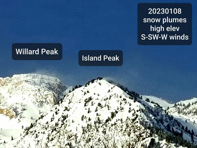
Temps felt fairly mild, reading low 20s F at the trailhead. However, wind chill definitely nipped at exposed skin. Skies were initially mostly sunny this morning but soon became overcast by 1030 or 11am. Snowfall turned on briefly for about 15 minutes around 145pm but soon wore itself out to little effect. The real player today was wind, out of the SW & W, cutting well into the low elevations, as low as 6000ft, with strong gusts. By 6500ft and above winds were consistently strong, and certainly increasing with elevation. Given the twigs falling off the trees, winds at mid elevation were 45-50mph or more throughout the day (aside from a random respite for about 15 minutes around 2pm). Snow transport was evident basically everywhere you looked. Uncharacteristically, there was a significant plume on Island Peak, which was enough to deter us from the mid elevation ridgelines and upper elevations in general.
Snow Characteristics
Snow Surface Conditions
Dense Loose
Wind Crust
Snow Characteristics Comments
I found a similar low elevation surface crust yesterday in the Sardine Peak zone as Greg reported on Cutler, but this morning it had all but disappeared. Surface snow was still soft, but relatively dense, ranging from F to 4F and cohesive. At low elevations, hand shears were easy, sliding on the crust 30cm deep. At mid elevations, bonding was better, with medium/hard shears about 60cm down on moist snow.
In exposed and not-so-exposed areas, wind affected snow took the form of wind skin or surface wind slabs ranging from 4F to 1F+ in spots.
Sheltered locations held soft turns despite wind even in those spots, but things were on the dense side.
Red Flags
Red Flags
Recent Avalanches
Wind Loading
Red Flags Comments
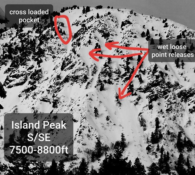
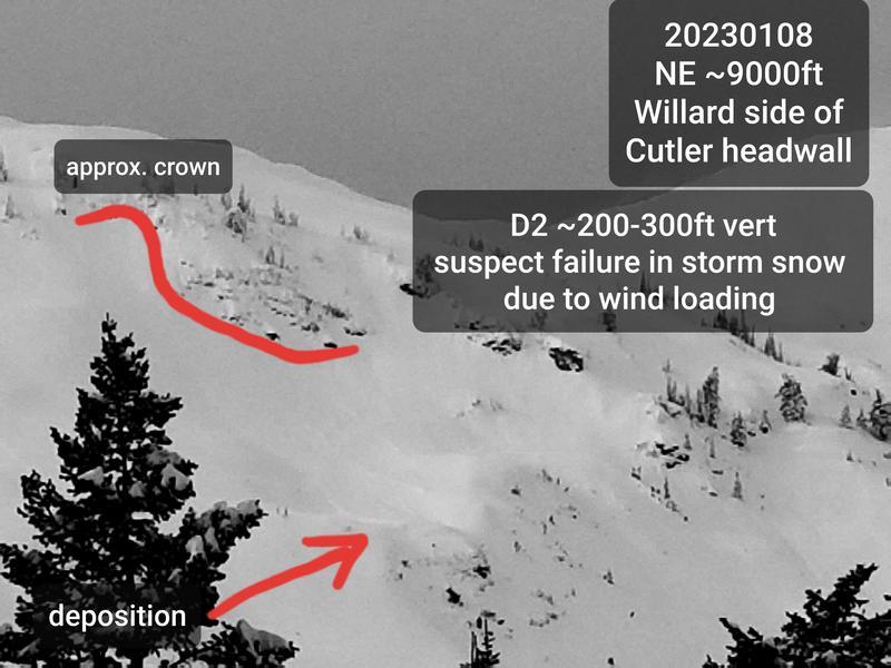
Wind affects were widespread. Cornices were growing along the Cutler headwall ridgeline, and there were bidirectional wind lips on the ridges of the birthday bowls. Leeward sides of the hogs back and dead tree were growing pillows. The Willard avalanches reported yesterday were all but filled in from the wind. We noted what appeared to be fresh deposition from a D2 slide on a NE aspect a couple hundred feet below the ridgeline south of Willard, stopping on a bench above the rocks (photo below). We also noted wet loose activity on the south side of Island Peak (not sure if from today or 20230107) and a small pocket (D1) that had ripped in the new/wind affected snow near the summit (looked like cross loading on an E aspect). Finally, we intentionally triggered a D1 avalanche in a N facing constriction around 7800ft on a 40 degree convex roll. This failed about 10cm deep x 50ft wide in the cohesive 4F surface snow.
Comments
Not the best photos given the distance, but annotations hopefully clear that up for the both the headwall and Island Peak activity.
Wind-blown snow plumes today.
Today's Observed Danger Rating
None
Tomorrows Estimated Danger Rating
None
Coordinates