Sign Up for the Utah Snow and Avalanche Workshop (USAW) on December 7th!

Observation: Wolf Creek

Observation Date
1/6/2023
Observer Name
W. Shirey
Region
Uintas » Wolf Creek
Location Name or Route
Wolf Creek Pass
Weather
Sky
Overcast
Precipitation
Light Snowfall
Wind Direction
West
Wind Speed
Moderate
Weather Comments
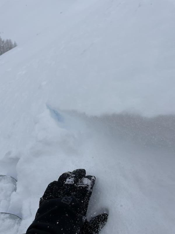
S1 rates of snow all day with moderate to strong westerly winds. We skied south and could see some wind loading and a little bit of cracking.
Snow Characteristics
New Snow Depth
7"
New Snow Density
Low
Snow Surface Conditions
Powder
Red Flags
Red Flags
Wind Loading
Cracking
Poor Snowpack Structure
Avalanche Problem #1
Problem
Wind Drifted Snow
Trend
Same
Avalanche Problem #2
Problem
Persistent Weak Layer
Trend
Decreasing Danger
Problem #2 Comments
The november facets were weaker than the wasatch and definitly not as deep leading me to believe it may be easy to trigger, however the thick 1F slab on top was very dense and would take a lot to fail. I probed all along the the south ridge and depths were between 120-145cm.
Snow Profile
Aspect
South
Elevation
9,700'
Slope Angle
28°
Today's Observed Danger Rating
Considerable
Tomorrows Estimated Danger Rating
Moderate