Sign Up for the Utah Snow and Avalanche Workshop (USAW) on December 7th!

Observation: Willows

Observation Date
12/10/2022
Observer Name
Kelly, Thompson
Region
Salt Lake » Big Cottonwood Canyon » Willows
Location Name or Route
Willow Fork to Park City Ridgeline
Weather
Sky
Broken
Wind Direction
Southwest
Wind Speed
Strong
Weather Comments
Moderate to strong southwest winds with warm temps (29 F). Winds were scouring southerly slopes and actively loading northerly slopes. Sun was out when the tour started and high clouds moved in throughout the tour.
Snow Characteristics
Snow Surface Conditions
Powder
Wind Crust
Snow Characteristics Comments
Mixed bag of snow conditions. Closer to the Park City Ridgeline some areas were scoured back to rocks and shrubs. Lower angle skiing was good with a breakable wind crust that wasn't too stiff.
Red Flags
Red Flags
Recent Avalanches
Red Flags Comments
We saw a wind drifted soft slab avalanche on northeast facing West Monitor.
Avalanche Problem #1
Problem
Wind Drifted Snow
Trend
Increasing Danger
Problem #1 Comments
Avalanche Problem #2
Problem
Persistent Weak Layer
Trend
Increasing Danger
Problem #2 Comments
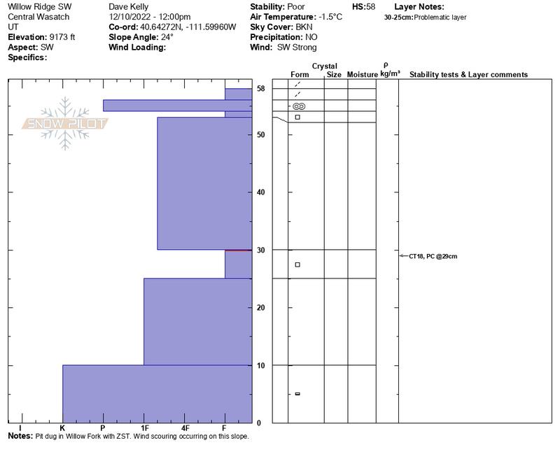
Poor structure in snowpits. Danger will increase with more snow and water weight with the next storm.
Snow Profile
Aspect
Northwest
Elevation
9,400'
Slope Angle
21°
Video
Today's Observed Danger Rating
Moderate
Tomorrows Estimated Danger Rating
Considerable
Coordinates