Planned Website Outage: The UAC website will be down for maintenance on June 17 from 2:00 - 7:00 PM MT.
icon-add
Observation
Menu
×
Menu
Forecasts
Logan
Ogden
Salt Lake
Provo
Uintas
Skyline
Moab
Abajos
Weather
Archives
How to read the forecast
Observations & Avalanches
Submit Observation
Observations Explorer
All Observations
Avalanches
Fatalities
Weather
Place Names Map
Archives
Education
Avalanche Class List
UAC Class List
Online Classes
Resources and Tutorials
Avalanche Awareness
Develop Skills
Events
Store
About
Contact
Who we are
Core Values
Staff
Board of Directors
Past Forecasters
Sponsors
Annual Reports
Sign In
Blog
Donate / Join
Search
Forecasts
Logan
Ogden
Salt Lake
Provo
Uintas
Skyline
Moab
Abajos
Weather
Archives
How to read the forecast
Observations & Avalanches
Submit Observation
Observations Explorer
All Observations
Avalanches
Fatalities
Weather
Place Names Map
Archives
Education
Avalanche Class List
UAC Class List
Online Classes
Resources and Tutorials
Avalanche Awareness
Develop Skills
Events
Store
About
Contact
Who we are
Core Values
Staff
Board of Directors
Past Forecasters
Sponsors
Annual Reports
Sign In
Blog
Menu
Search
icon-add
Observation
Donate / Join
Submit Observation
Observations Explorer
All Observations
Avalanches
Fatalities
Weather
Place Names Map
Archives
Submit Observation
Observations Explorer
All Observations
Avalanches
Fatalities
Weather
Place Names Map
Archives
Observation: Days Fork
Observation Date
12/6/2022
Observer Name
Torrey
Region
Salt Lake » Big Cottonwood Canyon » Days Fork
Location Name or Route
Days Fork
Weather
Sky
Few
Wind Speed
Calm
Weather Comments
Beaut of a day. Single-digit temps in the pre-dawn hours with moderate ridgetop winds. Temps warmed through the day and ridge-top winds tapered. S and SE took on heat and had a thin and fragile subsurface crust as we exited.
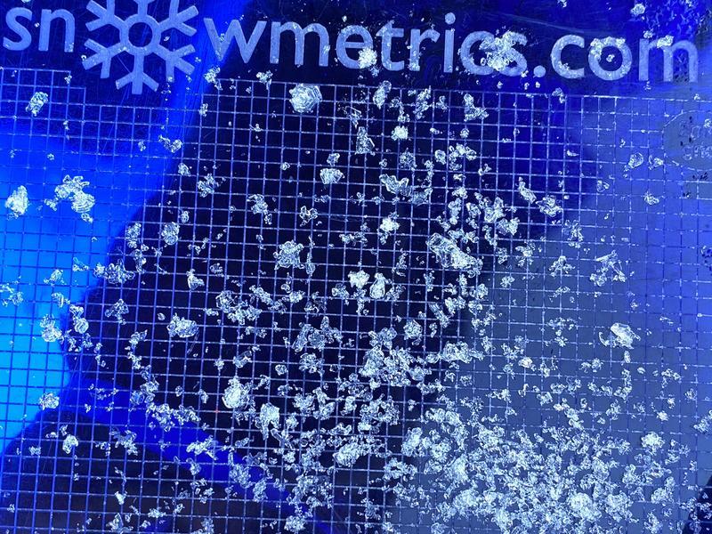
Snow Characteristics
New Snow Depth
12"
New Snow Density
Low
Snow Surface Conditions
Powder
Snow Characteristics Comments
Snow depths are generally 1.5 m to 1.75 m above 9000'
Red Flags
Red Flags
Collapsing
Poor Snowpack Structure
Red Flags Comments
The snowpack was mostly quiet. One localized collapse on a north aspect around 9000' as a skier stepped out of their skis and sunk into the snowpack.
Avalanche Problem #1
Problem
Persistent Weak Layer
Trend
Same
Problem #1 Comments
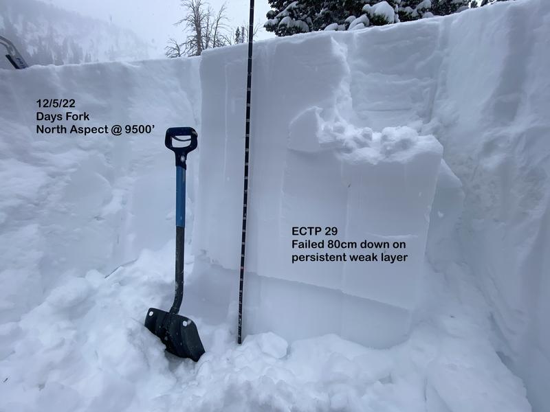
I've spent the last several days skiing and digging in Days Fork and have found poor structure with a slab sitting above a layer of facets in each pit. The slab varies in thickness and hardness depending on the slopes exposure to the strong wind event Nov 29-30. I have not noticed any avalanche activity failing on the persistent weak layer within this drainage. John Lemnotis did report
this avalanche
in Banana Days on Dec. 1
Test results have consistently produced propagation with moderate to hard force. ECTP 13, ECTP 29x2, ECTP31x2 and PST End 38/100. The weak layer is buried 60-80cm below the surface in the area and was not showing significant signs of strengthening or rounding where I observed. The recent avalanche activity along the Park City ridge line provides a clear example of the type of avalanche and potential size we're dealing with (
example 1
,
example 2
,
example 3
). The conditions in this area might be more stubborn to trigger than seen elsewhere but still possible.
Snow Profile
Aspect
Northeast
Elevation
9,600'
Slope Angle
32°
Today's Observed Danger Rating
Considerable
Tomorrows Estimated Danger Rating
None
Coordinates