Observation Date
11/4/2022
Observer Name
Manship
Region
Salt Lake » Little Cottonwood Canyon » Flagstaff Ridge
Location Name or Route
Flagstaff Area
Comments
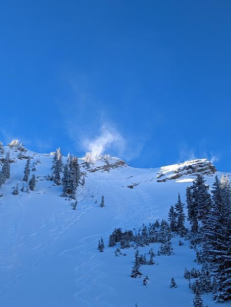
Good conditions exist where you are not skiing on rocks. It is still early out there but smooth slopes ride well. Stability was good, some small dry loose avalanches could be triggered in steep terrain today, but there is evidence of some D.5-D1 avalanches from the storm.
Snow feels right side up and new snow has bonded generally well, I think this will give us a good start to a base for coming storms.
Also, travelled on some remarkable well set skin tracks, bravo.
Photo 1: Wind affect from east winds
Photo 2: Wind Transport
Photo 3: Small dry loose
Photo 4: Incoming clouds


Today's Observed Danger Rating
Low
Tomorrows Estimated Danger Rating
Moderate
Coordinates


