

Observation Date
2/28/2022
Observer Name
Champion/Collett/Wilson/Delaney
Region
Salt Lake » Big Cottonwood Canyon » Cardiff/Mineral
Location Name or Route
LCC to BCC - Cardiff to Mineral Fork
Comments
Headed up for a bi-canyon day. Initially went up to Toledo bowl, where the snow surface was very damp, and we saw multiple wet avalanches that had either happened that morning or within the last 24 hours. While we were nearing the top of the Toledo bowl, we saw one human-triggered wet avalanche come down the east side of the Toledo bowl near the Flagstaff shoulder. Temperatures were very warm, and the wind was non-existent on the uphill. After reaching the ridgeline above Toledo bowl, we dropped into Holy Toledo, which was still holding cold, unconsolidated snow. In the upper pitch of Holy Toledo, there was a bit of wind effect from previous days, but there was no consolidated slab and no obvious signs of instability within that run. Near the bottom of Holy Toledo, between Powerline around 9400' was the first time the warm temperatures seemed to impact that north east facing slope.
We then ascended the east side of Powerline, which held multiple snow surfaces, primarily a stout temperature and sun crust from the morning, that had now begun to freeze over in the shade. From the ridgeline, we could see multiple natural wet avalanches that had crossed the skin track on Cardiac Ridge, but no other signs of instabilities or slab avalanches within the wind drifted snow or stepping down into the facets in upper Cardiff. After skiing Powerline we made our way towards Mid Ivory and Georges. That terrain also held variable snow surfaces, including temperature crusts with 1-2 cm of near-surface facets sitting atop the temperature crust. The east-facing aspects of the Mid Ivory and Georges Bowl where likely exposed to the sun earlier in the morning, and formed the temperature crust, so the 1cm of near-surface facets was likely happening as the east faces were now shaded and actively into the afternoon.
The East Fork of mineral held cold, unconsolidated snow atop of facets. The upper 30cm was cold, decomposing precipitation particles, sitting atop facets. Within that new so there were no obvious signs of instabilities like cracking, and collapsing. The lower pitches of the Mineral fork had begun very heavy and damp, and we saw one wet slide paralleling the east fork near 9600' on a west-facing aspect.
The primary takeaway seems to be that the facets exist, but in all of the terrain that we traveled today, we were unable to find a consolidated slab. Outside of areas that now have new snow sitting atop old weak faceted snow, many aspects (W-S-E) and all lower elevations have become very damp over the last two days of warming, and will now hold stout crusts. When we get more snow, we may finally be able to have a more consolidated, and cohesive slab atop the facets on those cold shaded aspects. On any aspects that now hold a firm crust, we will see fast and far running avalanches during and directly following any new snowfall. Especially in areas like east-facing aspects that still have the weak faceted snow, got a thin temperature crust, and could have a few cms of near-surface facets atop of the firm crust.
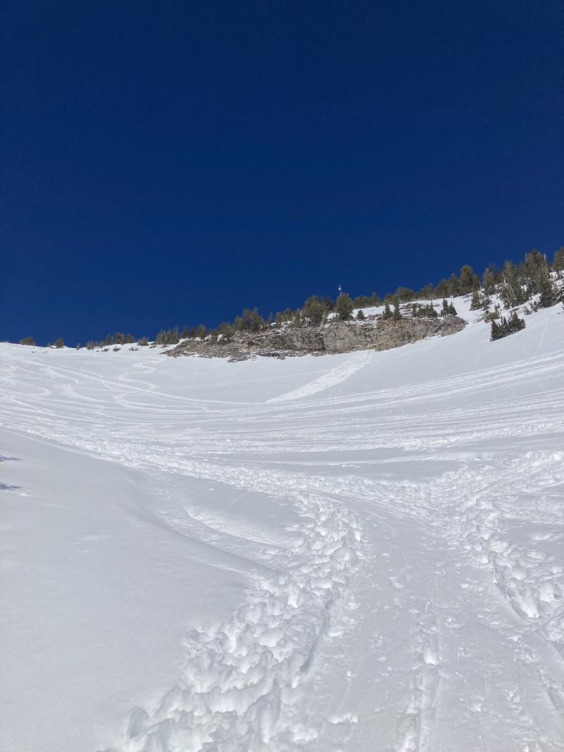
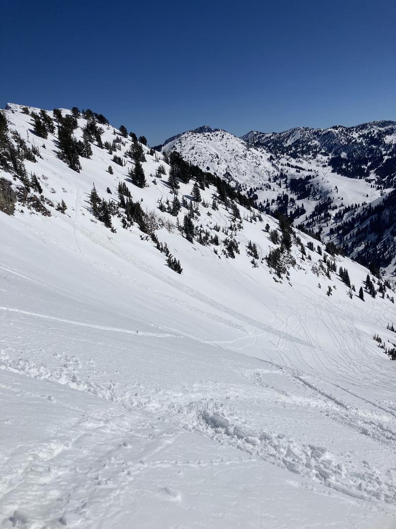
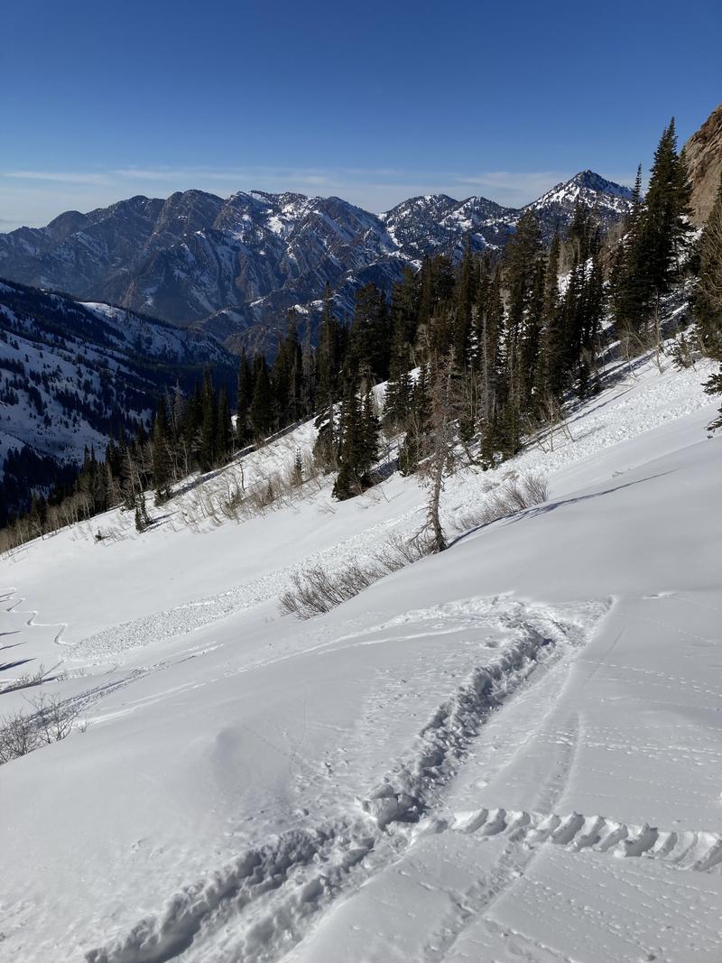
Attached are some photos of wet activity we witnessed throughout the day.
Today's Observed Danger Rating
Moderate
Tomorrows Estimated Danger Rating
Moderate
Coordinates