

Observation Date
2/2/2022
Observer Name
Hardesty
Region
Salt Lake » Park City Ridgeline » Monitors » West Monitor
Location Name or Route
West Monitor
Comments
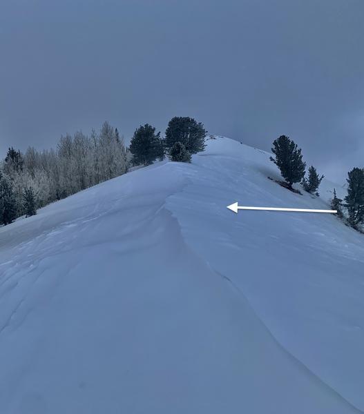
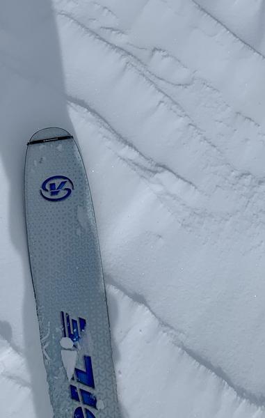
Went out alone mostly to look at the snow surfaces and compare the West Monitor snow structure that avalanched in early January and that which remains intact, in-situ. But mostly, with Low danger, it was just nice to go out and notice things. That the touch of north wind was building the slightest cornices facing south/southwest...that the smallest rime 'dots' rimmed the wind ripples along the ridge. That my hands were cold.
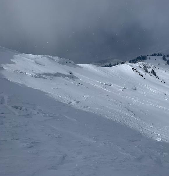
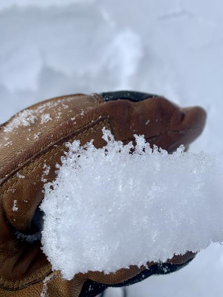
In general, found an HS of 50cm on the old bed surface from the early January avalanche....and about 150cm of HS in the intact snow peripheral to the slide. The bed surface had 40cm of very weak (fist to 4F) small grain facets (some chained) above the original basal ice crust; the intact area snow surface consisted of 20cm of very weak faceted recrystallized snow. Neither are particularly promising for easy and benign avalanche conditions if/when we see the next major loading event.
Photos:
- Noticing the N/NE wind
- Riming on wind textured snow surface --- riming pointing in the direction of provenance
- West Monitor avalanche
- Chains of facets just beneath the bed surface (crust flipped upside down)
Today's Observed Danger Rating
Low
Tomorrows Estimated Danger Rating
None