This week is the third annual
Avalanche Awareness Week in Utah. A lot is going on with over 20 different events around the state. You can find all the events
HERE.
Batteries for Beacons runs through Dec 19. Get free batteries for your transceiver and a chance to win 1 of 10 Black Diamond Rescue Kits, 1 of 3 Mammut Barryvox transceivers, or 1 of 3 BCA Tracker transceivers. Stop at a
participating shop, fill out our survey and get a free set of batteries. Don't need batteries, but still want a chance to win? Simply
fill out the survey to be registered.
Skies are clear.
Mountain temperatures are in the single digits.
Except for sustained 30mph hourly averages along the highest elevations, winds are generally less than 15mph from the west.
With another trace to 2" overnight, the two day storm totals are impressive:
LCC: 29"/2.12" (snow/snow water equivalent)
BCC: 24"/1.77"
Park City Ridgeline: 20"/1.45"
Ogden mountains: 16"/0.7"
Provo mountains: 16"/2.0"
Snow depths are now 3-5' up high and riding conditions are vastly improved.
The Outlook -
For today, we'll see increasing high clouds with light to moderate southwest winds. Temperatures will rise to the low 20s F by the afternoon.
As this storm fades from memory, our attention turns to the next storm churning in the Pacific. We'll see warming temperatures and increasing southwest winds Sunday and Monday ahead of what looks to be a decent snowfall event Tuesday/Wednesday. Southwest winds ahead of the storm are forecast to average 50-60mph.
It's Avalanche Season and conditions are dangerous in the backcountry.
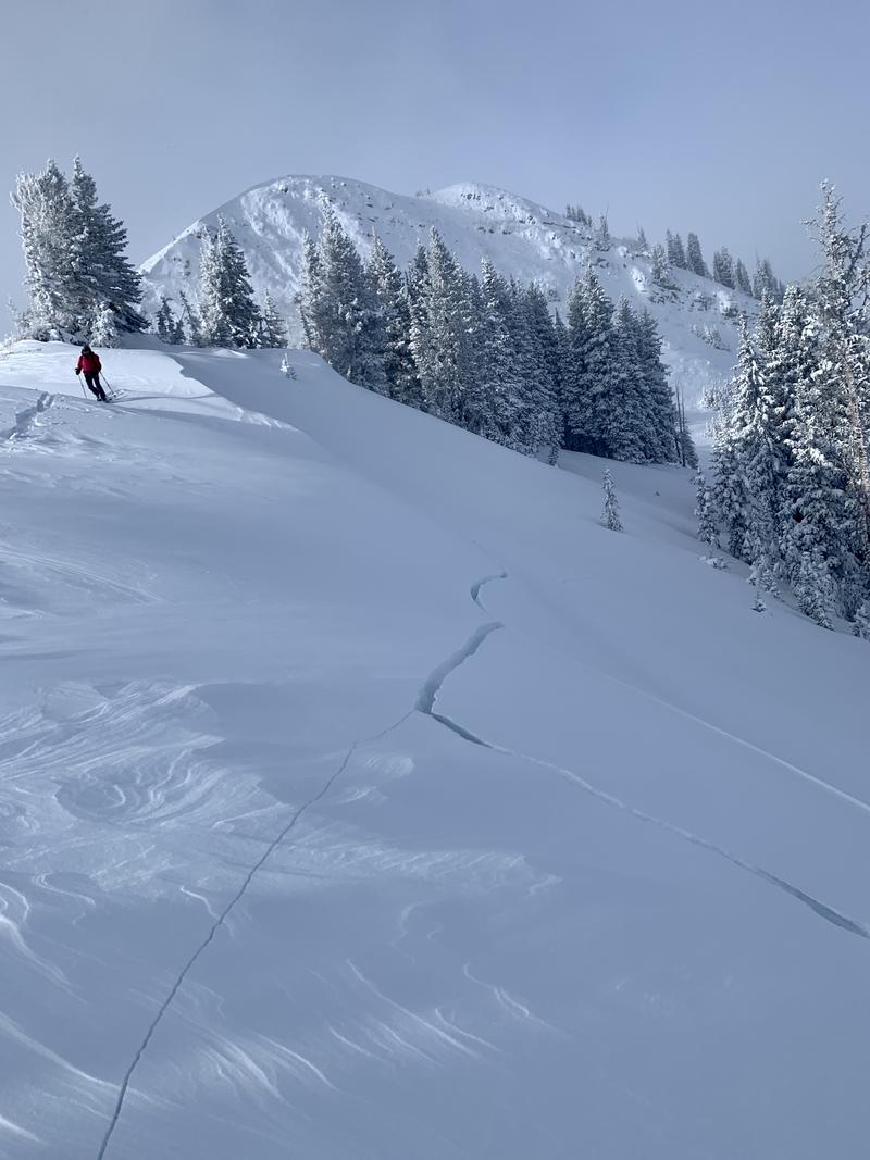
When you experience significant cracking and collapsing 200 yards from the trailhead (see video below), it's clear that all steep terrain that held old snow from October is off and to be avoided.
Backcountry skiers and riders triggered numerous soft slab avalanches 1-2' deep yesterday. Most were 50-150' wide with one releasing "wall-to-wall" 1000' wide in West Monitor Bowl along the Park City ridgeline.
Aspects and elevations included nearly* all of those that harbored old faceted snow from October: mid and upper elevation northwest to east facing terrain.
Many riders reported triggering avalanches at a distance and/or from the safety of a ridgeline, with some avalanches releasing well off the ridgelines and in more protected terrain (ie: gladed and sheltered not open alpine slopes)
(*mid and upper elevation westerly facing slopes were not reported to have avalanched, but they remain suspect.)


