


Observation Date
12/9/2021
Observer Name
Greg Gagne
Region
Salt Lake » Little Cottonwood Canyon » Grizzly Gulch
Location Name or Route
Grizzly - Twin Lakes Pass - Patsy
Comments
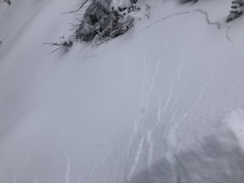
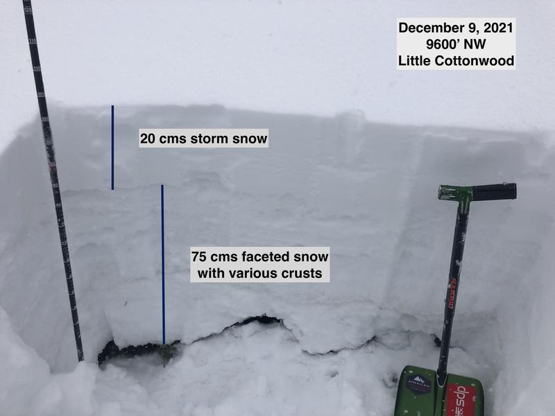
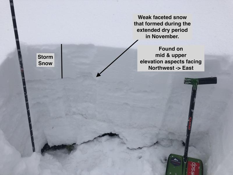
The first real storm of the year that falls onto an existing snowpack is always tricky as there is so much spatial variability. Most slopes facing the south half of the compass were bare dirt prior to this storm, so any storm snow instabilities should settle out quickly. The northerly aspects are more of a concern as many of these slopes had a patchwork of weak, faceted snow at the surface. In my field work today I was finding that the new snow was bonding reasonably well to the old snow where the surface was crusted. But on slopes where the old snow surface was weak and faceted, it was very easy to get cracking in the storm snow where the old snow was a reactive weak layer.
I would stay clear of avalanche terrain (slopes > 30°) on north-facing slopes at the mid and upper elevations as there is the potential for avalanches failing on this faceted layer. Avalanches may be triggered remotely and also occur naturally during any period of higher precipitation or any wind-drifting.
Photos are of cracking in the storm snow as well as a very weak pit on a NW aspect right at the transition point between mid and upper elevations.
For Friday's forecast, I am inclined to go with a Considerable danger rating for mid and upper elevation northerly aspects as the storm snow and fresh wind drifts are sitting on top of weak, faceted snow.
Today's Observed Danger Rating
Moderate
Tomorrows Estimated Danger Rating
Considerable