Join us at our 2nd Annual Blizzard Ball

Observation: Grizzly Gulch

Observation Date
4/15/2021
Observer Name
Mark Staples
Region
Salt Lake » Little Cottonwood Canyon » Grizzly Gulch
Location Name or Route
Grizzly Gulch
Weather
Sky
Obscured
Precipitation
Light Snowfall
Wind Direction
Southwest
Wind Speed
Light
Weather Comments
Cloudy and snowy, but the sun appeared briefly around 3 p.m. Very little wind at the top of Patsy Marley
Snow Characteristics
New Snow Depth
17"
New Snow Density
High
Snow Surface Conditions
Powder
Snow Characteristics Comments
Wednesday's snow was dense and well bonded. Instabilities from Wednesday had settled out.
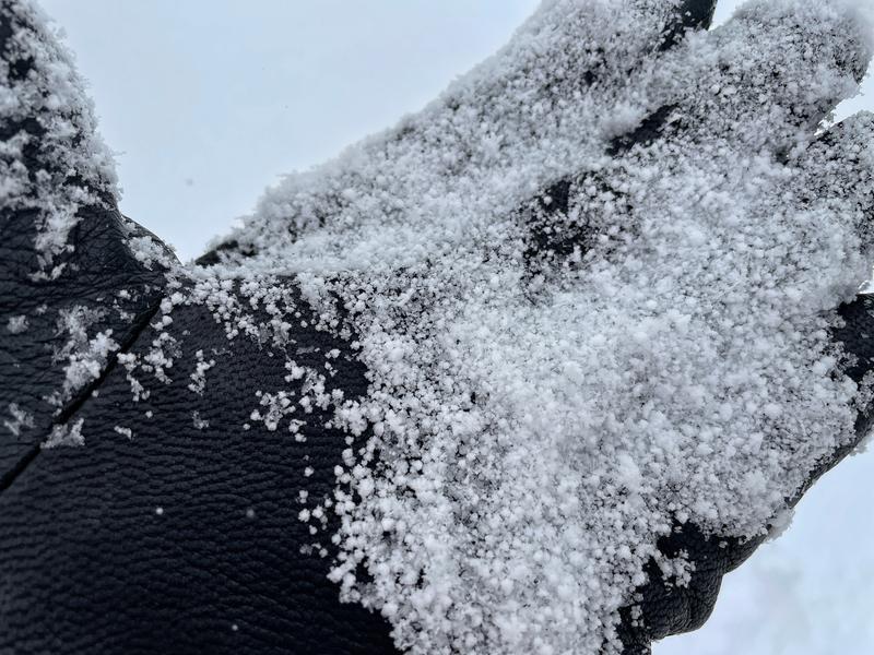
Snow overnight and during the day made great conditions as it was dry and loose. The upper 3-4 inches was mostly graupel and would sluff easily.
Below 9000 feet the snow was taking some heat.
Avalanche Problem #1
Problem
New Snow
Trend
Decreasing Danger
Problem #1 Comments
Soft slab avalanches of new snow were easily triggered on Wednesday. They mostly failed on low density snow that fell Tuesday night which was capped by dense snow that feel Wednesday.
This instability has mostly ended as the snow has settled and bonded to itself and to the old crust underneath.
These are great conditions to go to upper elevations for powder skiing and riding. I would not go ski mountaineering until the new snow sits for a while because the margin for error in ski mountaineering is razor thin.
Avalanche Problem #2
Problem
Wet Snow
Problem #2 Comments
Wet snow was not a problem today and won't be on Friday, but it will be this weekend as soon as strong sunshine hits the new snow.
Comments
Photo below of new snow depth at 9600 feet. ECTX (this means the new snow didn't crack under my shovel as I tapped on it, a good sign.
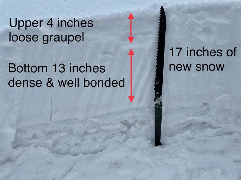
Photo below of the small graupel snow crystals that made up the upper 3-4 inches of snow.
Today's Observed Danger Rating
Moderate
Tomorrows Estimated Danger Rating
Low
Coordinates