
Greg Gagne
Forecaster
Our Week in Review highlights significant snowfall, weather, and avalanche events of the prior week. (Review the archived forecasts for the Salt Lake mountains.)
This is our last Week in Review for the 2020-21 season. We hope you have found this a useful feature for your backcountry planning and awareness. It will return in December once the 2021-22 season begins.
The danger roses for the Salt Lake mountains from Friday, April 9 through Thursday, April 15:
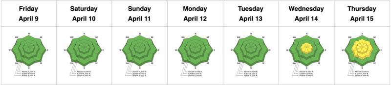
Summary: Clear skies and a generally cool start through Tuesday, April 12. Beginning late Tuesday, a period of unsettled weather enters the region, with a heavy burst of snow snowfall on Wednesday, with continued snow showers through Friday. The only notable avalanche activity was a cycle of natural and human-triggered avalanches during a period of high precipitation intensity on Wednesday.
Friday, April 9 - Tuesday, April 13: Clear skies and generally cool weather with no avalanche activity reported as the colder temperatures and winds kept the snow surface cool.
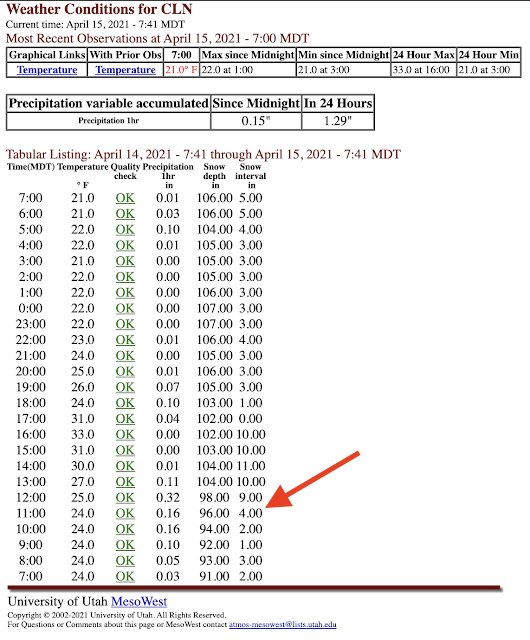
Wednesday, April 14: A storm system enters the region, with a period of intense snowfall midday. Between 11 am and 12 noon, upper Little Cottonwood Canyon reported 5" snow in one hour! Jim Steenburgh's Wasatch Weather Weenies blog describes the meteorological conditions that made this unique event occur.
There was also an avalanche cycle during the mid-day period of precipitation intensity, with both natural and human-triggered avalanches reported. This included a person getting caught in Two Dogs in Days Fork (photo below). All avalanches were soft slabs running within the storm snow, or at the interface with the old snow surface.
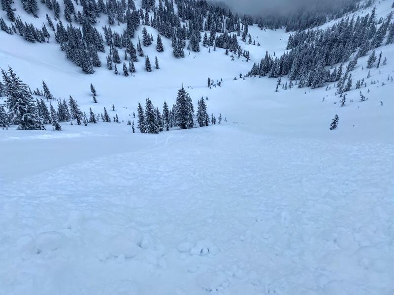
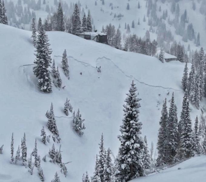
Photo of a natural avalanche in Grizzly Gulch
Thursday, April 15: Snowfall totals by the end of the day on Thursday are 1-2', with the highest amounts in upper Little Cottonwood Canyon. Storm snow instabilities from Wednesday rapidly settled out, with sluffing in the storm snow on steeper aspects as well as an avalanche involving a pocket of recent storm snow in just above East Bowl Pass in Silver Fork.


