Join us at our 2nd Annual Blizzard Ball

Forecast for the Salt Lake Area Mountains

Mark Staples
Issued by Mark Staples on
Wednesday morning, April 7, 2021
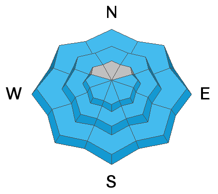
Today, the avalanche danger is MODERATE with heightened avalanche conditions on slopes receiving direct sunshine and slopes with wind drifted snow. The new snow will become wet on many slopes and produce wet loose avalanches. Where the snow is shaded and remains dry, look for recently formed soft slabs of wind drifted snow.
Places to avoid avalanches will be slopes at mid and upper elevations shaded from the sun and sheltered from the wind.
Low
Moderate
Considerable
High
Extreme
Learn how to read the forecast here
Weather and Snow
Snowfall yesterday:
11-13" of snow (1.05" water) - Little Cottonwood
6-11" of snow (.46-.85" water) - Big Cottonwood
4-8" of snow (.25-.8" water) - Park City Ridgeline
This morning under clear skies, temperatures are in the upper teens to low 20s F. Winds at most ridgelines are blowing 5-10 mph from the northwest with a few higher gusts. At 11,000 feet, northwest winds are blowing 25 mph with gusts to 40 mph.
Today will have clear, sunny skies. Warm air will slowly move up from the south although the strong sunshine is what will really help temperatures warm into the 30s F. Upper elevations may only reach the upper 20s while lower elevations should break into the low 40s F. Winds will shift from the northwest to the west blowing 10-15 mph.
Recent Avalanches
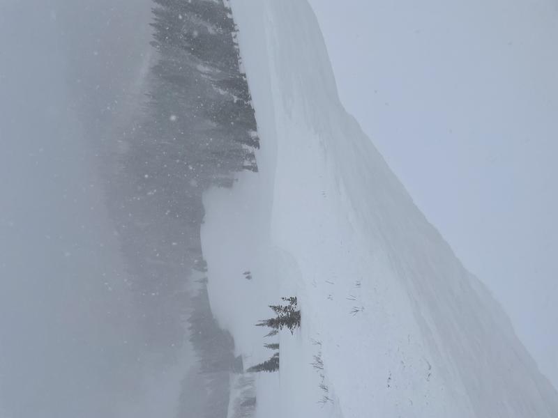
Yesterday, ski areas reported some soft slab avalanches of new snow and wind drifted snow. There were also three slides reported in the backcountry on Reynolds Peak (photo below), near Brighton, and on Kessler Peak. All these slides were 8-15 inches deep, predictable, and somewhat slow-moving.

As always, find all recent observations HERE.
Ad
Avalanche Problem #1
Wet Snow
Type
Location
Likelihood
Size
Description
The new snow (4-13 inches) will warm quickly, become wet, and produce wet loose avalanches sliding on the ice crust underneath this new snow. You can trigger these slides at your feet; however, the main threat will be having one of these slides happen naturally above you.
Most of the wet avalanche activity should happen predictably on slopes receiving direct sunshine, starting with east facing slopes and progressing to south facing and then west facing slopes. Other slopes with exposed rocks and cliffs and even mid and low elevation, north facing slopes may warm up quickly and produce wet loose avalanches like this one that happened last week in the lower part of Little Cottonwood Canyon.
Avalanche Problem #2
Wind Drifted Snow
Type
Location
Likelihood
Size
Description
Soft slabs of wind drifted snow mostly formed during stronger, westerly winds yesterday. This morning, northwest winds at the highest elevations remain strong enough to continue transporting snow. Today you should be able to trigger these wind slabs up to about 12-18 inches deep. On slopes receiving direct sunshine, some of these slabs may release naturally as they quickly warm and possibly become wet. On more northerly facing slopes that could be cross-loaded, these wind slabs should be stabilizing and becoming less easily triggered.
Additional Information
General Announcements
Please visit this website with information about Responsible Winter Recreation by the Utah Office of Outdoor Recreation.

This information does not apply to developed ski areas or highways where avalanche control is normally done. This forecast is from the U.S.D.A. Forest Service, which is solely responsible for its content. This forecast describes general avalanche conditions and local variations always occur.