Join us at our 2nd Annual Blizzard Ball

Forecast for the Salt Lake Area Mountains

Nikki Champion
Issued by Nikki Champion on
Monday morning, April 5, 2021
Overnight temperatures did not allow for a solid refreeze and this morning mountain temperatures remain warm. Since the snowpack is starting out warm and wet this morning, it won't take much heating or sun for wet avalanches to occur.
Wet avalanches may be both natural and human triggered and occur on steep east, south, and west aspect where the avalanche danger should quickly rise to CONSIDERABLE this morning. All other slopes have a MODERATE danger and could also see wet snow avalanches especially at the low and mid-elevations. Most of these will be loose wet avalanches, but we could see wet slab avalanches occurring today as well.
Low
Moderate
Considerable
High
Extreme
Learn how to read the forecast here
Weather and Snow
This morning, in most areas mountain temperatures, remain above freezing with overnight temperatures bottoming out in the mid-30s F across the upper elevations right before sunrise. A few zones in Big Cottonwood are the exception, with Spruces reporting temperatures just around 30 F. Winds have slightly increased overnight and now blow from the west southwest at speeds of 10-15 mph with some gusts near 30 mph at upper elevations.
Today, a storm system will make its way through northern Utah late this afternoon through tomorrow morning. This means warm temperatures in the morning and increasing cloud cover throughout the day, with a slight chance of snow showers late this afternoon. Temperatures climb into the upper 50s F this morning, before decreasing throughout the day. Winds will be west southwesterly and average 10-15 mph with gusts up to 40 mph at the highest elevations.
Snow showers may develop late this afternoon and overnight, but accumulation will be on the light side. Expect 3-6" of new snow, and below-freezing temperatures overnight. Since we are on the snow topic, a more active pattern looks to set up sometime around April 12th, with the hope of some more powder riding. Stay tuned.
Recent Avalanches
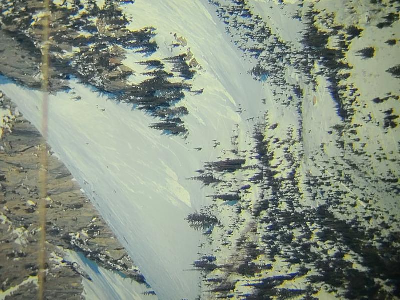
We had one report of a natural avalanche out on Lone Peak that was large enough to catch, carry and bury a human. Resorts continue to report wet loose avalanches occurring throughout the day.
Photo from the Wet Loose avalanches on Lone Peak (C. VanSkiver)

Our Week in Review highlights significant snow and avalanche events from the past week and has been published.
Ad
Avalanche Problem #1
Wet Snow
Type
Location
Likelihood
Size
Description
Wet Snow is a complex problem, as it can be very predictable and yet unpredictable at the same time. What does this mean? We know that the sun will rise and warm the snow surface, starting the melting process once again and create more wet avalanches as the day wears on. What we cannot predict is the exact extent or timing of the avalanche activity. We just know, that if the slope is wet and unconsolidated, we don't want to be on or underneath it. The Wet Snow Avalanche Problem covers two types of avalanches:
Wet Loose Avalanches - These typically occur within layers of wet snow near the surface caused by warming temperatures and strong sunshine. As the snow becomes wet, the upper surface layers become unconsolidated as the bonds between the snow grains lose their cohesion. They start at a point and typically fan out as they move downhill. These avalanches can entrain a lot of snow, especially in a tight rock-lined chute or in sustained steep terrain. The first sign of wet loose avalanches is usually rollerballs or pinwheels. Today, these avalanches can happen naturally or be human-triggered.
Wet Slab Avalanches - This is a tough one; we haven't seen any wet slab avalanche activity in the backcountry up to this point. However, now on our third night with temperatures above freezing, I wouldn't be surprised to hear some wet slab avalanche activity. Basically, the way this works is your slab (stronger snow) fails on wet saturated snow grains below in the snowpack somewhere. Meltwater can also saturate a layer of snow, and that becomes the weak layer releasing the slab of stronger snow above.
If you want to dive deeper into Wet Slab Avalanches check out this paper on this topic HERE.
Additional Information
Glide avalanches happen when the entire snowpack starts moving downhill on top of some smooth surface like a rock slab, and then at some point, the snow releases and produces an avalanche.
Glide avalanches only happen in a few specific places like Broads Fork, Mill B South, and Stairs Gulch, where large rock slabs exist under the snowpack. Several glide avalanches happened in Broads Fork on March 2nd and March 5th. Two people died in a glide avalanche in 2001 on April 28th in Stairs Gulch. Avoiding these areas during this intense warming would be wise.
General Announcements
Please visit this website with information about Responsible Winter Recreation by the Utah Office of Outdoor Recreation.

This information does not apply to developed ski areas or highways where avalanche control is normally done. This forecast is from the U.S.D.A. Forest Service, which is solely responsible for its content. This forecast describes general avalanche conditions and local variations always occur.