Forecast for the Moab Area Mountains

Issued by Eric Trenbeath on
Saturday morning, April 3, 2021
Saturday morning, April 3, 2021
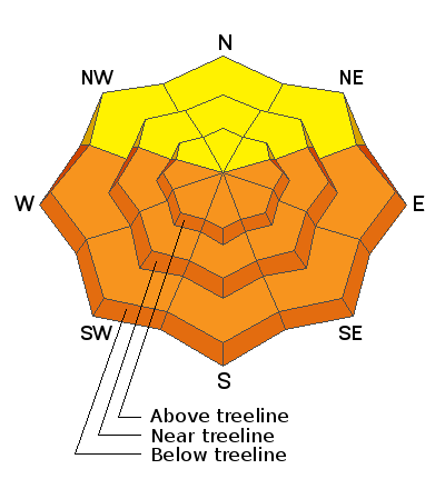
Soaring temperatures will cause the danger for loose wet, or even wet slab avalanches to quickly rise to MODERATE on all sun-exposed slopes. With record temps in the forecast, and with light to no overnight refreezes, the danger could reach CONSIDERABLE later in the day. Signs of instability include rollerballs, pinwheels, and punchy or sloppy unsupportable snow. Timing is everything, work slope aspects according to the sun and get off of and out from under steep slopes as they become wet and sloppy.
An isolated or MODERATE avalanche danger exists on very steep slopes above treeline that face NW-N-NE where stiff slabs overlying weak, faceted snow can still be found. Very warm temperatures may increase the likelihood of triggering an avalanche on this weak, faceted snow. Shallow snowpack areas with steep convexities and rocky, more radical terrain are where you are most likely to trigger an avalanche.

Low
Moderate
Considerable
High
Extreme
Learn how to read the forecast here
 Special Announcements
Thanks to everyone who donated to our Spring Awareness Campaign!
The Geyser Pass Road is melted down to the dirt up to the parking lot.
The Lower Utah Nordic Alliance is through grooming for the season.
 Weather and Snow
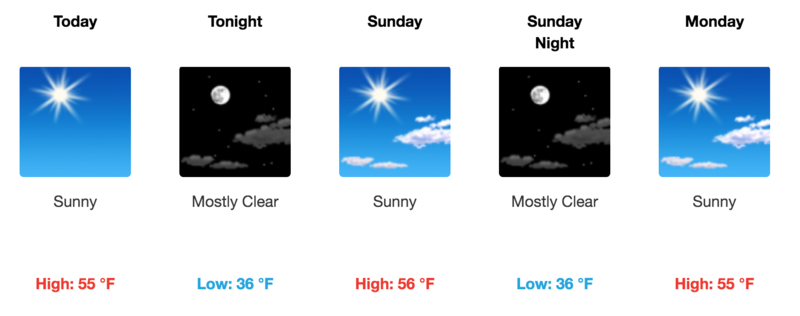
Get the latest overnight temperatures with this real-time weather links.
Wind, temperature, humidity on Pre Laurel Peak (11,700')
SNOTEL site near Geyser Pass Trailhead (9600')
Storm totals and temperatures at the Gold Basin study plot (10,000')

Snowpack Discussion
A light freeze overnight should make for some short-lived corn conditions on southerly aspects this morning but once the supportable crust becomes wet and you are punching through, it's time to get off of steep slopes. Work aspects with the sun starting with SE by around 10:00, and finish up on WSW by around noon. If you are leaving deep ruts and the snow is getting punchy, wet, and sloppy, you are too late.
Weak, sugary, faceted snow still exists near the ground, especially at higher elevations on NW-E aspects. Warm temperatures and percolating water in the snowpack may make these layers more reactive to the weight of a skier or rider. Slopes with steep convexities and rocky, more radical terrain are where you are most likely to trigger an avalanche failing on this weak, faceted snow.
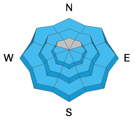
Avalanche Problem #1
Wet Snow
Type
Location

Likelihood
Size
Description
Loose Wet Avalanches:
The danger for loose wet avalanches will quickly rise today as a strong sun melts the thin surface crust. Signs of instability include rollerballs, pinwheels, and "point release" sluffs that fan out and gather more snow as they travel down the slope. Timing is everything today, and you need to get off of steep slopes as they become wet and sloppy.
Wet Slabs:
Record temps and light to no overnight re-freezes increase the possibility for wet slab avalanches. This type of wet snow avalanche is harder to predict than loose wet it but can be invariably more dangerous. Wet slabs release when melt water saturates a layer in the snowpack and the overiding slab fails as a cohesive layer. Outward signs of this type of problem are not obvious but sloppy, wet, or punchy snow indicates that the pack is trending towards unstable.
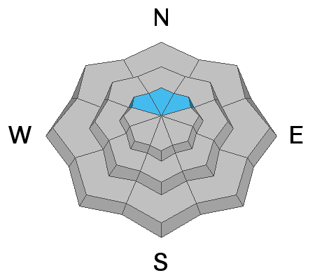
Avalanche Problem #2
Persistent Weak Layer
Type
Location

Likelihood
Size
Description
Weak, sugary, faceted snow still exists near the ground, mostly above treeline on NW-N-NE aspects. Warm temperatures and percolating water in the snowpack may make these layers more reactive to the weight of a skier or rider. Thinner snowpack areas around steep convexities, or in rocky, more radical terrain are where you are most likely to trigger an avalanche failing on this weak, faceted snow.
General Announcements
This forecast is from the U.S. Forest Service, which is solely responsible for its content. This forecast describes general avalanche conditions and local variations always occur.


