Observation Date
3/21/2021
Observer Name
Paradis
Region
Salt Lake
Location Name or Route
Lambs Canyon
Weather
Sky
Clear
Wind Direction
Northwest
Wind Speed
Calm
Weather Comments
Nice day out. Sunny in the morning then increasing clouds during the day. Warm in the sun but relatively cool overnight temps helped keep things from overheating too quickly at low elevations as can happen this time of year. By the afternoon, small snow squalls would move through and provide a quick dusting of snow.
Snow Characteristics
New Snow Depth
10"
New Snow Density
Medium
Snow Surface Conditions
Powder
Damp
Snow Characteristics Comments
Snow stayed pretty good throughout the day, even at low elevations but did start to develop a slight temperature crust. This was barely noticeable as you would ski through it but could be more pronounced tomorrow. Snow was a bit better above 8000 feet. Low elevation slopes that stayed shady may still have good snow tomorrow.
Red Flags
Red Flags
Heavy Snowfall
Rapid Warming
Red Flags Comments
Not really too many red flags today at low elevations but it did just snow and I was interested in how well the new snow bonded to the old. Snow yesterday was really warm and wet which likely helped bonding - it was snowing at 37 degrees yesterday morning at 7000 feet, then slowly cooled to about 32 by mid afternoon. By this morning it was 18. As noted above, it was warm but didn't get really, really hot like it can this time of year.
Avalanche Problem #1
Problem
New Snow
Problem #1 Comments
Snow seemed well bonded and didn't notice any cracking or other signs of instability. Less sluffing today than yesterday afternoon. We were on relatively low angle slopes facing N through E, so this could have been more of an issue on steeper or higher elevation slopes. I couldn't tell for sure but it did look like there was some loose snow rollerballing in on one higher elevation slope.
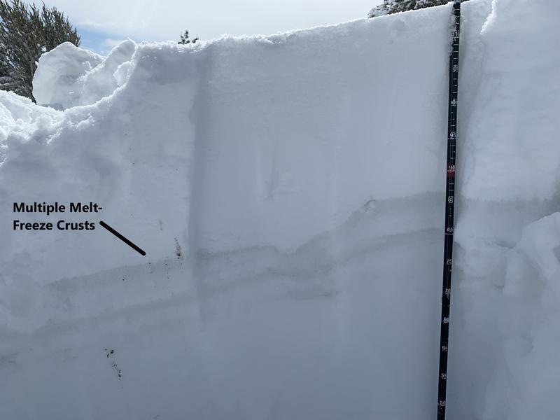
Snow Profile
Aspect
Northeast
Elevation
7,600'
Slope Angle
19°
Comments
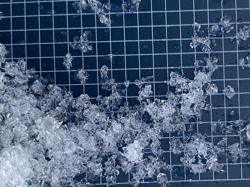
Dug in this location about a month ago. Facets are rouding much more than at that time. Snow depth actually wasn't all that different. About a foot of snow has melted/consolidated but new snow largely replaced (for now) what was lost over the last month. Snow has also transitioned to a more spring type pack with multiple melt-freeze crusts.
Today's Observed Danger Rating
Moderate
Tomorrows Estimated Danger Rating
Low