

Observation Date
3/15/2021
Observer Name
Bill Nalli
Region
Uintas » Upper Chalk Creek
Location Name or Route
Upper Chalk Creek
Comments
The winds..
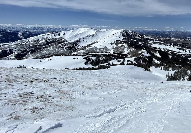
Always a big player in snowpack instability but likely the main factor in most direct-action avalanches. The very strong NE-N winds on March 13-14 totally transformed the Uintas and lead to a couple N-D2's in upper Chalk Creek. Averages 40-50 gusts up to 68mph. The unusual NE wind direction stripped every windward slope in its path and took the western part of the range from a smooth 6"-12" coating of soft powder to a ravaged lunar landscape of sastrugi or variable intermittent punchy wind slab. It just doesn't seem fair. Pic 1 of a NW facing sub-ridge whose entire winter snowpack was stripped in less than one day.
Approximately 18 hours of very strong NE winds stripped and compacted NW through E to S aspects. This includes many of the aspects with the most concerning weak snow structure near the ground. It's still unclear how much it affected stability on whats left of the depth hoar but it's safe to say that it was a major stabilizing factor in general. Any slope with snow available for transport was left with sastugi and raised old ski tracks. No slab left above the basal weak layer. As with everything avalanche there's always exceptions and these two slides on NW facing Windy Ridge show that all that snow had to get transported somewhere. In this case, where it fell onto steep weak complex terrain with a long open leeward fetch, naturals occurred sometime during peak winds March 14.
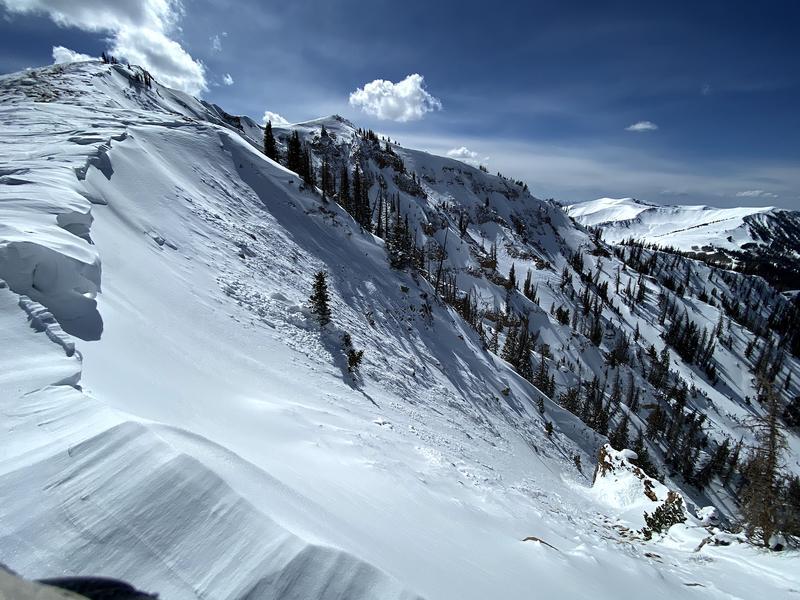
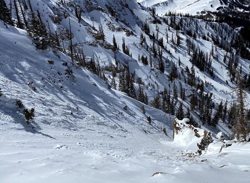
Pics show naturals on the NW aspects of Windy Ridge in Upper Chalk Creek. Further in the distance, slightly different aspects of W and NE are simply stripped down to rock and sastrugi.
Other mid and upper elevations slopes are left with an unusual mid slope wind slab that is stubborn to unreactive. Caution is advised on any new wind drifts.
Today's Observed Danger Rating
Moderate
Tomorrows Estimated Danger Rating
Moderate
Coordinates