

Observation Date
3/14/2021
Observer Name
Chasen
Region
Salt Lake » Big Cottonwood Canyon » Days Fork
Location Name or Route
Days Fork
Comments
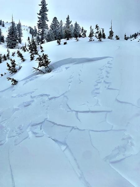
Temp was right at 32°F (0°C) at Spruces at 0700, OVC, S-1, winds non existent. By 0830 at 8300ft winds were moderate out of the NNE, snow trasnport was not observed due to poor visibility. Dug on a NE aspect at 9200ft. Wind loading was present in much of this area on similar aspects. HS-220. ECTN7 down 20cm within the new snow. Top 110-120cm of the snowpack where we dug was right side up, did not dig below 120cm. At 1100 as we ascended above 9500ft NE winds picked up significantly and was period of most intense wind, with consistent snow transport throughout. Skies began to break around 1200. Reactive wind slabs and rapid warming today. The combination of winds, warm temps and later in the morning/early afternoon sun, were continuing to do a number on the riding conditions while we were out. Made for some on your toes skiing, as the day wore on.
Today's Observed Danger Rating
Moderate
Tomorrows Estimated Danger Rating
Moderate