Observation Date
3/13/2021
Observer Name
Davis
Region
Uintas » Wolf Creek
Location Name or Route
Wolf Creek Pass
Weather
Sky
Overcast
Wind Direction
West
Wind Speed
Light
Weather Comments
Mostly light to moderate snow showers with an occasional break with sunshine. Snow fell throughout the day and up high it appears that this storm dumped about 18' of fresh snow.
Snow Characteristics
Snow Surface Conditions
Powder
Melt-Freeze Crust
Snow Characteristics Comments
This storm was/is a great reset for the western Uintahs. Most areas we traveled (above 9700') we enjoyed at least 18" of fresh powder on top of a solid base. However, be careful at lower elevations. The new snow is inviting but the old cooked snow layer is very solid and un forgiving. You can get bucked around easily hitting old hidden tracks. Stay patient and seek out higher elevations with deeper snow.
Red Flags
Red Flags
Heavy Snowfall
Wind Loading
Rapid Warming
Avalanche Problem #1
Problem
Wind Drifted Snow
Trend
Same
Problem #1 Comments
Newly formed wind slabs on top of old snow and/or ice crust could prove to be active at higher elevations.
Avalanche Problem #2
Problem
Wet Snow
Trend
Increasing Danger
Problem #2 Comments
As the Sun shines bright and high on southerly slopes watch out for newly formed wind slabs to become damp, heavy and possibly give way to an avalanche if disrupted.
Snow Profile
Aspect
Southwest
Elevation
9,500'
Slope Angle
17°
Comments
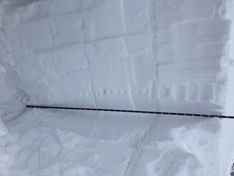
I decided to dig a pit on a South facing aspect to see new snow and ice crust interface. As far as i could tell the new snow was settling quickly (judging by hand hardness) as seen by the pic below. Below the new snow is a meaty ice crust that even proved difficult to cut with a snow saw. As seen with the pic below, there is a few ice crust layers followed by dense snow eventually bottoming out in a layer of facets from ground level to about 35cm.
Today's Observed Danger Rating
Moderate
Tomorrows Estimated Danger Rating
Moderate
Coordinates