

Observation Date
3/10/2021
Observer Name
Michael Janulaitis
Region
Uintas » Hoyt Peak
Location Name or Route
Hoyt Area
Comments
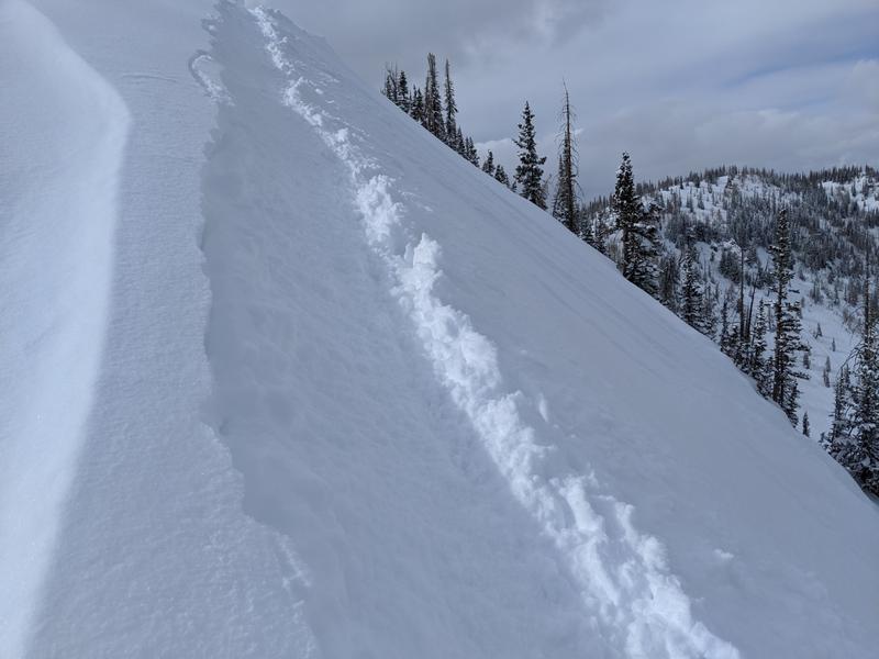
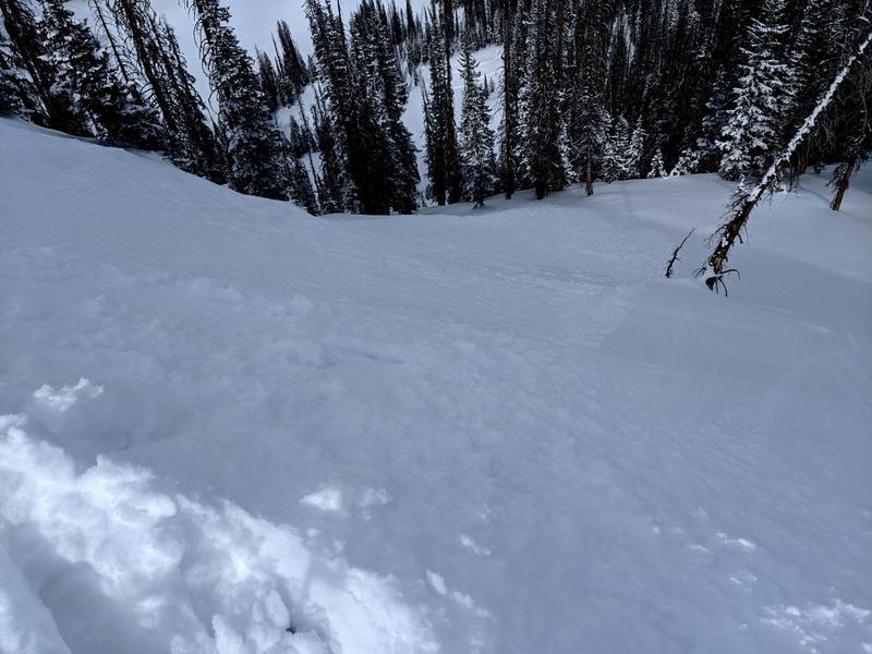
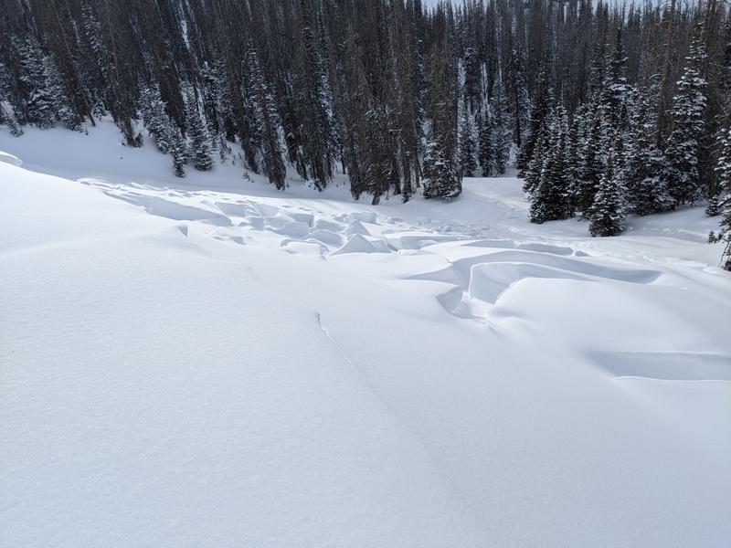
I got out this afternoon to find 7 inches of light powder on-top of a melt freeze crust or dense loose in the deep north trees. Up high on the steep north I was able to ski cut the new snow sending it 3/4s the way down slope. All of my turns in the steep trees produced sluffs which I had to either let run past me, adjust my line or make sure I stayed in front. The sluffs were consuming all of the new snow and running fast. If I extrapolate my findings I would expect open slopes, that have not been wind effected, to generate large enough and fast enough sluffs that a skier or rider could easily be dragged where ever the snow wants to go.
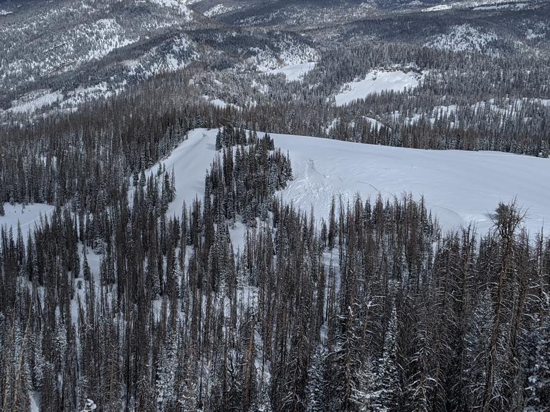
Many of the east facing slopes are littered with deep slab avalanches from the last two weeks.
A steep NW facing slope which I've never seen slide before and is often used as an access from one side of the mountain to the other pulled out these last two weeks. Usually there is much more snow in this area which tells me that the thin snow pack is the primary cause of the overloaded snow pack failing.
Down low the snow is damp, unsupportive and probably isothermic.
Today's Observed Danger Rating
Moderate
Tomorrows Estimated Danger Rating
Moderate