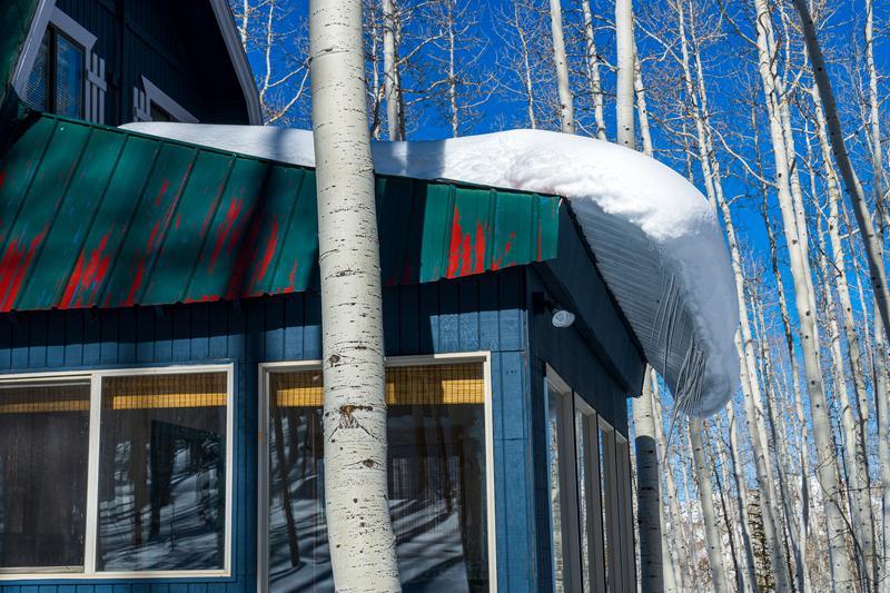
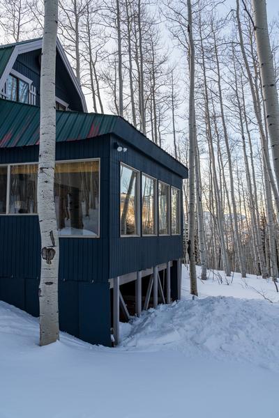
The most interesting wet avalanche activity I saw all week was today--off the roof of the cabin where we're cabin-sitting this week. Being an avalanche geek as well as an avalanche forecaster (at least a retired one after 40 years) I just had to take a photo of the glide I've been watching for a couple days occurring off the roof above the bedroom. It's what we call a glide avalanche; lubricated on the bottom by meltwater, it slides slowly like a glacier until it randomly releases catastrophically. This roof is a north facing slope of about 15-20 degrees. Granted, there's probably some heat added from the bottom as well as from the air temperature because the house is heated. It didn't take a genius to predict that it was well on its way to the BIG KERTHUMP, probably sometime during the afternoon or evening, by my estimate. At exactly 5:38 this evening, well, I became a very proud avalanche forecaster. I guess this is what retired avalanche forecasters do. See before and after photos below. It's the most excitement we've had around here all week, at least in the avalanche department. As far as the natural snowpack, most of the wet avalanche activity occurred a couple days ago with the last warming. With a brief cooling last night and today along with a good refreeze, wet activity was diminished but could pick up again tomorrow with less of a forecasted freeze overnight. But then again, the forecast for increased wind tomorrow should probably keep some of the wet activity in check. Plus, it's the second warming so the snow has been-there-done-that and the snow porosity and drainage channels have already been established so, in theory, wet activity should not be as much of a problem. But watch out for those roof avalanches.