Observation Date
2/20/2021
Observer Name
Ted Scroggin
Region
Uintas
Location Name or Route
Whitney Basin-West Fork Bear
Weather
Sky
Broken
Precipitation
Moderate Snowfall
Wind Direction
Northwest
Wind Speed
Light
Weather Comments
Periods of light to moderate snow throughout the day with a few inches accumulating and looked like about 4-5" from overnight. Winds were generally light to moderate and only on the ridge lines.
Snow Characteristics
New Snow Depth
5"
New Snow Density
Medium
Snow Surface Conditions
Powder
Snow Characteristics Comments
Mostly nice soft powder conditions with some wind affected snow in the exposed areas. Still a little punchy in low and mid elevation areas, but gain some elevation and better supportable riding and quite good snow.
Red Flags
Red Flags
Wind Loading
Collapsing
Poor Snowpack Structure
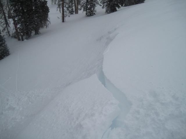
Red Flags Comments
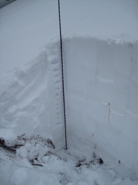
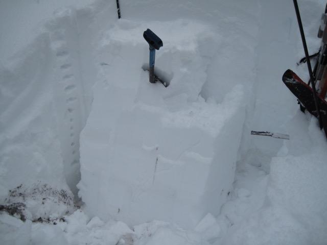
Northwest winds today were adding to the hazard creating some drifted snow that would crack out along the windy terrain. I did experience one fairly unsettling collapse as I approached a ridge line, but did not observe any cracking in the snow. I was finding a fairly deep snow pack for this area with about 170cm (70") but could still locate sugary faceted snow near the ground and a ECP28 which I found a little surprising.
Avalanche Problem #1
Problem
Persistent Weak Layer
Trend
Same
Problem #1 Comments
Even where the snow pack is getting deeper I was still able to get the weak sugary snow near the ground to collapse with an ECT test, although it did take several hard taps from the shoulder. Feels like all you need to do is give a good thump to a slope or find a shallow spot and the whole snow pack comes crashing down.
Avalanche Problem #2
Trend
Decreasing Danger
Problem #2 Comments
The wind drifted snow today was cracking out up to a couple feet deep while traveling along the more windy exposed ridges.
Comments
In this snow pit where the total snow depth was 170cm (70"), I was still able to get a crack to propagate across the column after 28 hard hits from the shoulder. This is good information that the snow pack can produce an avalanche on the weak snow near the ground. It is more difficult to trigger an avalanche where the snow pack is getting deeper, but where the snow is thinner it becomes much more likely.
The recent wind drifted snow today would crack out, but this problem might be less sensitive tomorrow.
Today's Observed Danger Rating
Considerable
Tomorrows Estimated Danger Rating
Considerable
Coordinates