

Observation Date
2/17/2021
Observer Name
McKinley Talty
Region
Salt Lake » Big Cottonwood Canyon » Cardiff Fork
Location Name or Route
Cardiff Fork
Comments
Went up to Cardiff Fork just to investigate the new snow, had no intention of skiing or traveling below any steep slopes and consequently did not make it very far. However, it was nice to walk in some deep snow.
I dug a snowpit on a NW facing slope at 7430' and found the height of snow to be 185cm. New snow from 2/12/21 stacked up around 80cm and seemed fairly right-side-up, however it was bonding poorly to the old snow interface (see video) and within the new snow at the 2/15 storm-break (see test results in SnowPilot graph). There were multiple layers below the new snow with large jumps in layer hardness, making for a fairly complicated snowpack (see photo 1).
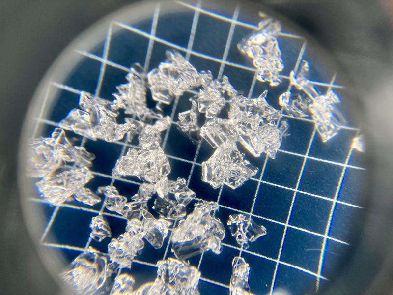
While the main concern for today was new snow instabilities, facets near the ground are still a major worry. Photo 2 shows large faceted grains that lurk deep below the snow surface. I think it's fair to say the PWL problem has now turned into a Deep PWL problem, which scares me even more. While it may be harder to get this layer to react after the recent storm, all it takes is a shallower trigger point for this dragon to wake up with a fiery vengeance.
Video
Today's Observed Danger Rating
Extreme
Tomorrows Estimated Danger Rating
High
Coordinates