icon-add
Observation
Menu
×
Menu
Forecasts
Logan
Ogden
Salt Lake
Provo
Uintas
Skyline
Moab
Abajos
Weather
Archives
How to read the forecast
Observations & Avalanches
Submit Observation
Observations Explorer
All Observations
Avalanches
Fatalities
Weather
Place Names Map
Archives
Education
Avalanche Class List
UAC Class List
Online Classes
Resources and Tutorials
Avalanche Awareness
Develop Skills
Events
Store
About
Contact
Who we are
Core Values
Staff
Board of Directors
Past Forecasters
Sponsors
Annual Reports
Sign In
Blog
Donate / Join
Search
Forecasts
Logan
Ogden
Salt Lake
Provo
Uintas
Skyline
Moab
Abajos
Weather
Archives
How to read the forecast
Observations & Avalanches
Submit Observation
Observations Explorer
All Observations
Avalanches
Fatalities
Weather
Place Names Map
Archives
Education
Avalanche Class List
UAC Class List
Online Classes
Resources and Tutorials
Avalanche Awareness
Develop Skills
Events
Store
About
Contact
Who we are
Core Values
Staff
Board of Directors
Past Forecasters
Sponsors
Annual Reports
Sign In
Blog
Menu
Search
icon-add
Observation
Donate / Join
Submit Observation
Observations Explorer
All Observations
Avalanches
Fatalities
Weather
Place Names Map
Archives
Submit Observation
Observations Explorer
All Observations
Avalanches
Fatalities
Weather
Place Names Map
Archives
Observation: Upper Weber Canyon
Observation Date
2/12/2021
Observer Name
Wes
Region
Uintas » Upper Weber Canyon
Location Name or Route
Upper Weber Canyon
Weather
Sky
Overcast
Precipitation
Light Snowfall
Wind Direction
Southwest
Wind Speed
Moderate
Weather Comments
Moderate to strong winds throughout the day. New snow in the area was certainly being transported and loading fast on leeward aspects.
Snow Characteristics
New Snow Depth
4"
New Snow Density
Medium
Snow Surface Conditions
Powder
Red Flags
Red Flags
Wind Loading
Cracking
Collapsing
Poor Snowpack Structure
Red Flags Comments
Wind loading and thunderous whoomphing.
Avalanche Problem #1
Problem
Persistent Weak Layer
Trend
Increasing Danger
Problem #1 Comments
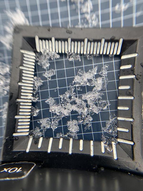
ECTP17@35
PST32/100End 35
I was shocked when I saw the failure on 17 compressions. I was under the impression from being in the Wasatch that the PWL was healing just a bit. I've seen numerous ECTXs. Not the case in the much shallower snowpack of the Uintas. If we get this storm load like predicted I think the Uintas are in for a big avalanche cycle.
Avalanche Problem #2
Problem
Wind Drifted Snow
Trend
Increasing Danger
Snow Profile
Aspect
Northwest
Elevation
9,200'
Slope Angle
26°
Today's Observed Danger Rating
Considerable
Tomorrows Estimated Danger Rating
High
Coordinates