

Observer Name
Adam Bellomy
Observation Date
Saturday, January 30, 2021
Avalanche Date
Saturday, January 30, 2021
Region
Salt Lake » Mill Creek Canyon » west porter
Location Name or Route
West Porter Fork
Elevation
9,600'
Aspect
East
Trigger
Natural
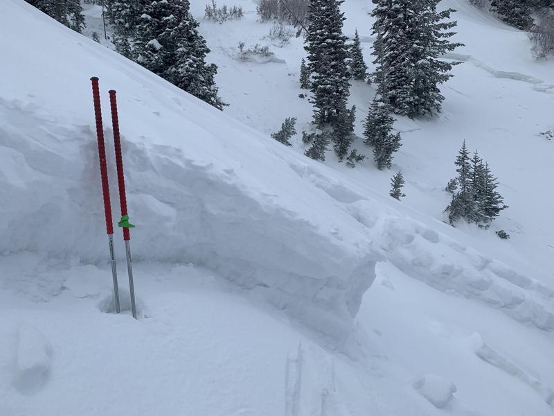
Depth
3'
Width
500'
Comments
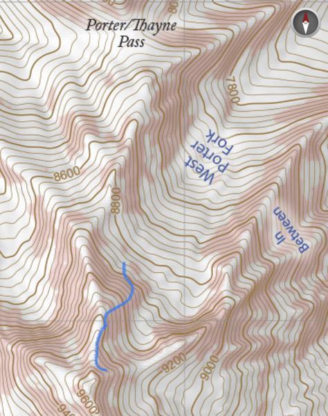
Came accross a pretty big natural avalanche in West Porter Fork. Looked like it started as a storm slab triggered by a cornice falling along the upper headwall. At about 9,300ft in elevation the slide stepped down to the facets at the ground. I couldn't see the entire crown line, but it looked to be at least 500ft wide and ran about 600-700ft vertical. One of the debris piles was easily 10+ feet deep. I included an image of the topo map with a blue line showing the crown.

Coordinates