Forecast for the Uintas Area Mountains

Craig Gordon
Issued by Craig Gordon on
Wednesday morning, January 20, 2021
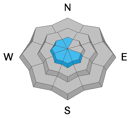
Today you'll find MODERATE avalanche danger near and above treeline, particularly on slopes facing northwest through southeast. Ironically, this terrain has the best coverage and the most snow, but human triggered avalanches are POSSIBLE, especially on steep slopes loaded by recent winds. Any slide triggered may break into weak, sugary, faceted snow, creating a larger avalanche than you might expect.
All other slopes at mid and low elevations offer minimal snow cover and generally LOW avalanche danger.
The best places to ride are shaded slopes near treeline with the deepest snow. But you'll need to put some thought into it... avoid slopes with fresh drifts and terrain steeper than 30 degrees and you'll avoid avalanches.
Low
Moderate
Considerable
High
Extreme
Learn how to read the forecast here
Special Announcements
Discount lift tickets are available thanks to the generous support of our local resorts, Ski Utah, and Backcountry. Support the UAC while you ski at the resorts this season. Tickets are available here.
Weather and Snow
Nowcast-
Skies are clear and temperatures nearly 10 degrees warmer than yesterday at this time, currently registering in the mid teens and low 20's. West and southwest winds blow in the 20's along the high peaks. Monday night's storm delivered a thin coat of white paint, but recent winds ravaged our big, upper elevation alpine terrain, transforming it into a lunar landscape. And while riding and turning conditions are a bit underwhelming, any day in the mountains is better than a day in the office :)
Forecast-
Look for mostly sunny skies with temperatures climbing into the mid 30's. West and southwest winds remain reasonable, blowing in the 20's and low 30's along the high ridges. Clear skies overnight allow temperatures to dip into the teens.
Futurecast-
A similar day is on tap for Thursday and then a slow-moving storm system slides into the region Friday night through late Saturday. A break for Sunday and another storm with colder air arrives Monday. More details to follow in the next few days, but the big takeaway is a pattern change is on the horizon.

Looking for real-time temps, snow, or wind?
Click here and then on the "western Uinta" tab for western Uinta specific, weather station network.
Recent Avalanches
No significant avalanche activity to report. But you can check here for updated trip reports and avalanche observations..
Ad
Avalanche Problem #1
Persistent Weak Layer
Type
Location
Likelihood
Size
Description
JG's beautiful pit profile clearly illustrates where the avalanche dragon resides in our current snowpack setup. The structure remains suspect and recent snowpit tests suggest you could still trigger a slide that breaks 2' deep, failing on weak, sugary, mid-pack facets. (ECTP 18 reflects these results)
Common characteristics (1) The snowpack is generally weak, rotten, and full of facets. (2) Strong winds have blown from nearly every direction, forming hit-or-miss wind slabs on top of this weak, sugary mess.
What does all of this mean? Below treeline, the snowpack is basically one big persistent weak layer lacking a slab on top to create an avalanche. Near treeline snow depths increase some, and there is more of a slab on top of the weak snow, but they aren't nearly as sensitive as they were last week.
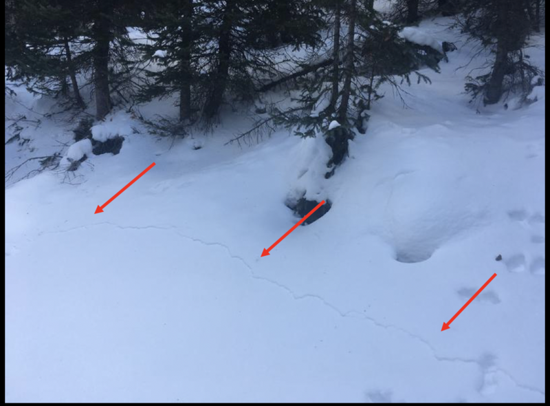
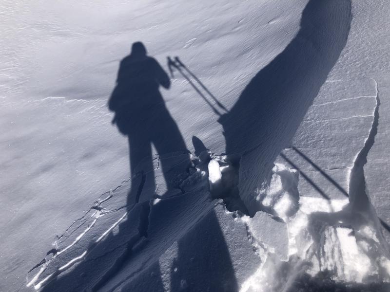
Today you'll want to look for signs of unstable snow like cracks shooting out in front of you, sudden collapses of the snowpack, or loud whoomphing sounds.
Avalanche Problem #2
Wind Drifted Snow
Type
Location
Likelihood
Size
Description
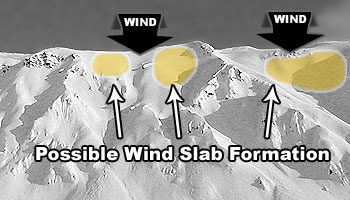
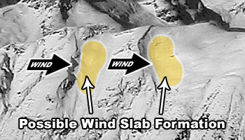
Unusual conditions make unusual avalanches- Monday nights atypical east-northeast winds found what little snow there is available for transport, forming stiff wind slabs on the leeward side of upper elevation ridges. Remember that strong winds create slabs in odd locations, so I'd also be on the lookout for fat, rounded pieces of snow lower downslope than we expect and around terrain features like chutes and gullies. In either case, you'll want to avoid today's fresh drifts which will look like small humpbacks lurking in our mountains and may sound hollow like a drum.

There are two types of wind loading patterns to look for - top loading and cross loading as shown in the two images below.
Additional Information
I will update this forecast by 7:00 AM tomorrow, Thursday January 21st.
Your observations are import, so please let me know what you're seeing... click HERE and contribute to this amazing community based program
General Announcements
If you see or trigger an avalanche or just wanna let me know what you're seeing you can reach me directly at 801-231-2170 or [email protected]
This forecast is from the U.S.D.A. Forest Service, which is solely responsible for its content. This forecast describes general avalanche conditions and local variations always occur.