Forecast for the Salt Lake Area Mountains

Drew Hardesty
Issued by Drew Hardesty on
Wednesday morning, January 13, 2021
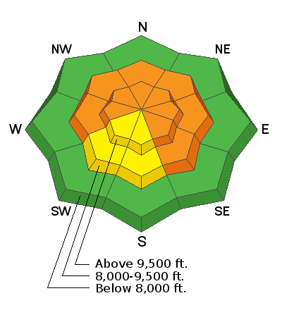
We'll see a rising avalanche danger today. By the afternoon, I anticipate the avalanche danger to be CONSIDERABLE on many aspects at the mid and upper elevations. Human triggered avalanches in the newly wind blown snow will become increasingly likely...and there is some potential of new wind drift avalanches stepping down into older weaker layers in the snowpack.
REMEMBER - IF YOU ARE GOING OUT OF BOUNDS AT A SKI AREA, YOU ARE STEPPING INTO CONSIDERABLE AVALANCHE DANGER.
Low
Moderate
Considerable
High
Extreme
Learn how to read the forecast here
Special Announcements
Thanks to the generous support of our local resorts, Ski Utah, and Backcountry, discount lift tickets are now available. Support the UAC while you ski at the resorts this season. Tickets are available here.
Weather and Snow
Skies are overcast.
The remnants of a decaying atmospheric river will bring warming temperatures, howling winds, freezing rain and rime to the Wasatch Range today. Air quality conditions in the valleys, however, will improve.
Currently, mountain temperatures are in the mid-20s. Trailheads and basins are in the low 30s. Winds are 15-20mph from west-northwest with 11,000' gusts near 50mph.
Snow surface conditions are a mix of wind and sun crust with soft settled powder in sheltered terrain. Don't complain. Wait til tomorrow.
For today, the Logan and Ogden mountains may see some initial precipitation this morning and then the bulk of the Wasatch range will see some precipitation (freezing rain, rime) by midday into late afternoon. It's possible that the Logan mountains will see a couple inches of snow tonight.
The Outlook: Cooling overnight and clearing for Thursday. A warming trend puts mountain temps into the mid-30s by week's end. We see only a few weak systems until perhaps the 21st/22nd of the month. We'll see.
Recent Avalanches
No reports of avalanches from the backcountry yesterday. A list of reported avalanches from the 8th are below. Find them all in our database HERE.
1/11/2021 Avalanche: Guild Line Salt Lake Skier 2.5' 200'
1/10/2021 Avalanche: No Name Bowl Salt Lake Snowboarder 16" 125'
1/9/2021 Avalanche: Silver Fork Salt Lake Skier 16" 30'
1/9/2021 Avalanche: Pioneer Bowl Salt Lake Unknown 16" 100'
1/8/2021 Avalanche: Main Porter Salt Lake Skier 16" 60'
1/8/2021 Accident: Dutch Draw Salt Lake Skier 2' 150'
1/8/2021 Avalanche: Mineral Fork Salt Lake Unknown 2' 100'

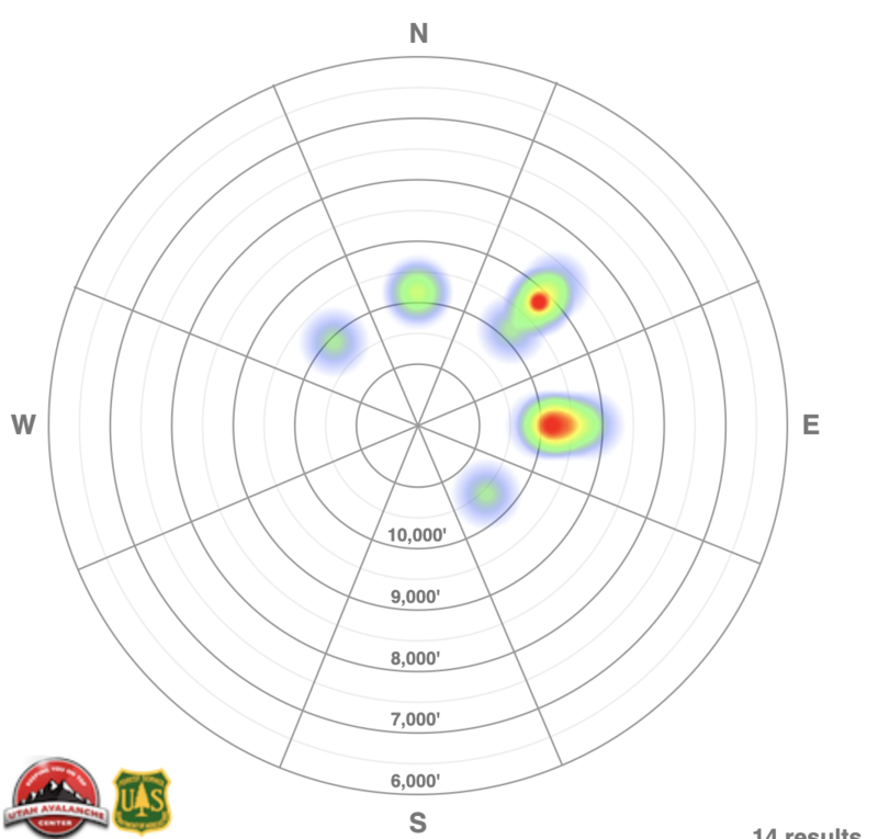
A HEATMAP of the reported avalanches since January 1st is below. Note that most of our avalanches are on northeast to east facing aspects above 9000'.
Ad
Avalanche Problem #1
Persistent Weak Layer
Type
Location
Likelihood
Size
Description
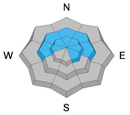
We have a conditionally unstable snowpack with strong snow over weak snow. This poor structure is on west to north to southeast facing terrain at the mid and upper elevations.
Avalanche frequency has diminished and audible collapsing/whoomphing are less common. One way to look at this might be that your odds of triggering a dangerous avalanche have dropped from - say - 30% to 15%. The odds just aren't good enough right now. As an interesting thought experiment, talk with your backcountry partners and ask what odds are acceptable.?
NOTE that avalanches involving persistent weak layers are often more variable and tricky than other avalanches. TRACKS ON THE SLOPE ARE NOT RELIABLE INDICATORS OF STABILITY.
Guide/educator Cody Hughes shows evidence of our poor snowpack structure below.
Avalanche Problem #2
Wind Drifted Snow
Type
Location
Likelihood
Size
Description
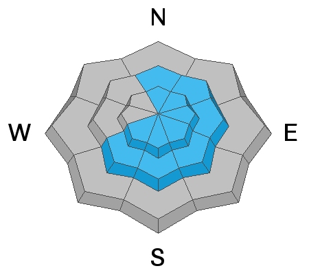
The danger for new and developing wind drifts will be on the rise today. By late afternoon into the overnight hours, I expect to see pockets of soft and hard wind slab scattered across the compass, though primarily on north to east to south facing slopes. In many cases, these fresh drifts will be sitting on recrystallized surface snow and/or potentially protected surface hoar crystals and may be particularly sensitive. As a result, these wind drifts may avalanche in inconsistent and surprising ways.
Note that some drifts may be well down off the ridgelines and cross-loaded in unusual gullies or depressions.
General Announcements
Please visit this website with information about Responsible Winter Recreation by the Utah Office of Outdoor Recreation.

This information does not apply to developed ski areas or highways where avalanche control is normally done. This forecast is from the U.S.D.A. Forest Service, which is solely responsible for its content. This forecast describes general avalanche conditions and local variations always occur.