Join us for the 17th Annual Professional Snow and Avalanche Workshop (PROSAW) on November 4 - Purchase tickets here!

Observation: Providence Canyon

Observation Date
1/7/2021
Observer Name
Toby Weed
Region
Logan » Providence Canyon
Location Name or Route
Right Hand Fork to Upper Providence Canyon
Weather
Sky
Overcast
Precipitation
Light Snowfall
Wind Direction
Northwest
Wind Speed
Light
Weather Comments
Just a short period of very light snowfall. Clouds descended to ridge level in the afternoon.
Snow Characteristics
New Snow Depth
4"
New Snow Density
Medium
Snow Surface Conditions
Powder
Snow Characteristics Comments
Much less new snow from the storm at the beginning of the week than farther north. Overall snow pack is very shallow, and off trail riding is dangerous due to the potential of hitting rocks, stumps and down logs.
Red Flags
Red Flags
Recent Avalanches
Cracking
Collapsing
Poor Snowpack Structure
Snow Profile
Aspect
East
Elevation
8,500'
Slope Angle
Comments
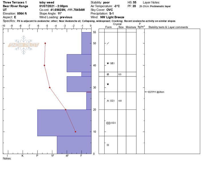
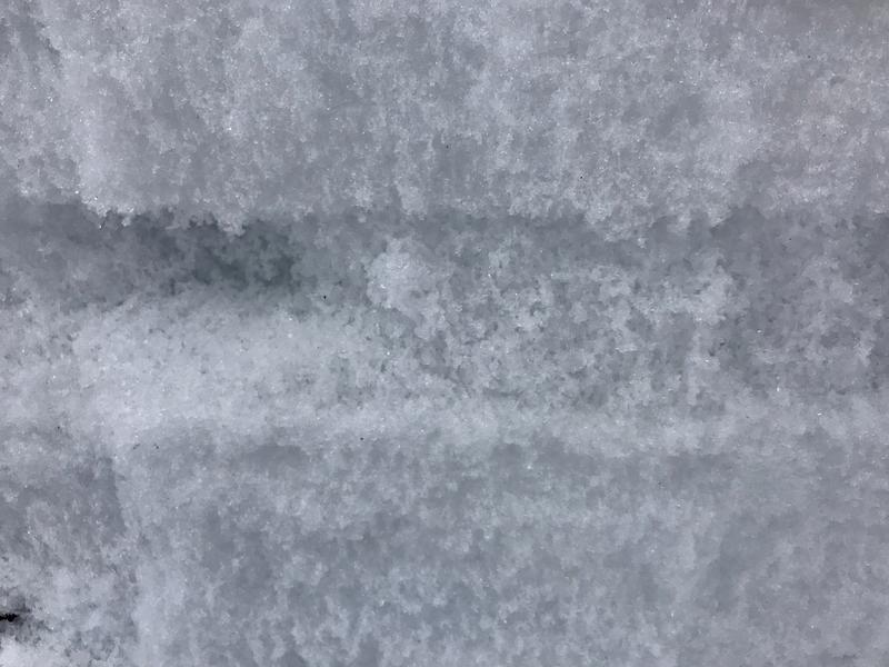
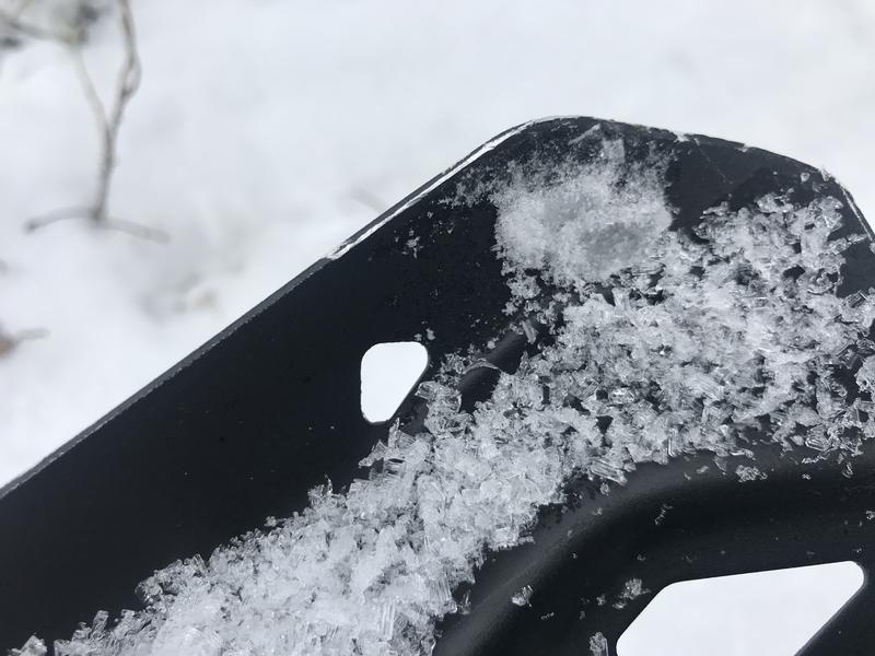
I found a very loose and well developed sugary persistent weak layer. I tried several extended column test and got ECTP results on all, ranging from ECTP 6 in a very shallow area to ECTP 13 at a more average depth ~80 cm.
Video
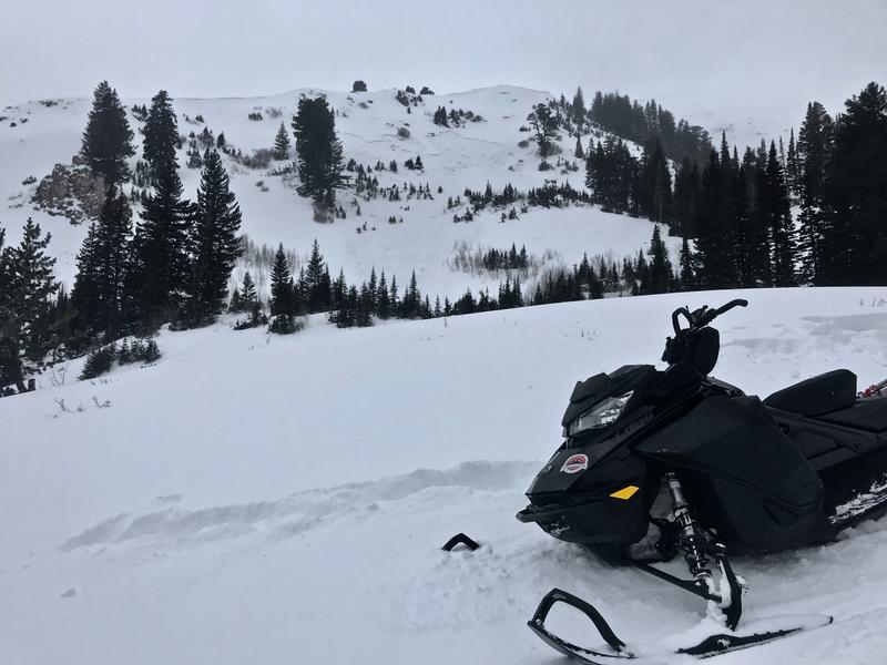
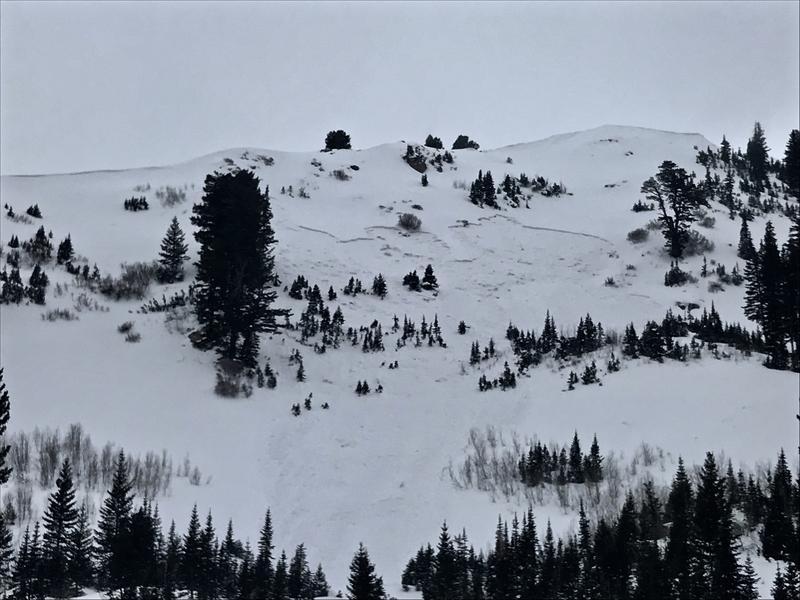
I went up to Providence Canyon to check out remote triggered avalanches from Wednesday. This one in lower Three Terraces Bowl (east facing around 8900') was triggered from several hundred feet away, by riders down in the flats. It was 250 to 300' wide, 1 to 2' deep and ran around 500 vrt'.
Today's Observed Danger Rating
Considerable
Tomorrows Estimated Danger Rating
Considerable