


Observation Date
1/4/2021
Observer Name
Jimmy G.
Region
Salt Lake » Little Cottonwood Canyon » Grizzly Gulch
Location Name or Route
Grizzly Gulch
Comments
I began my tour at 1215. It was warm and relatively calm at the trailhead; temps hovering around the mid-30's, sparse wispy clouds, a high sun. I noticed the wind from the SW sporadically transporting snow, but only on ridgelines at the highest elevations.
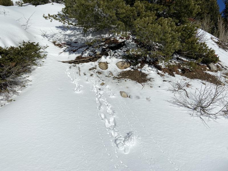
At about 9,000' on a NW aspect, some pole probing showed 5-10cm of dense, settled new snow over 5-10cm of sun crust. There was a similar setup on a nearby S-facing slope, and even some roller balls (picture 1).
At 1300, I noticed increasing cloud coverage, increasing winds, and observed graupel blowing around the surface of the snow. I bounced on a SE-facing test slope at 9,500' and found dense settled new snow over a supportable crust. I did not observe any evidence of cracking or collapsing.
Shortly after, I decided to dig some pits. The first one was on a N-NW-facing slope, in a very shallow and weak section of the snowpack (55cm). I hopped off of my skis and penetrated all the way to the ground, and continued to posthole around. Total depth only 55cm here. The setup: 10cm F, 5-10cm 4F, 5cm 1F, 10cm 4F, F to ground. As expected, this shallow pit failed at the faceted layer on the ground. ECTP2. Q2.
I dug another pit just 30m away in a N-NW-facing slope and found a depth of 95cm. Penetrated about ankle deep. The setup: 15cm F, 5-10cm 4F, 10cm 1F, 15cm F, 1F to ground. Surprisingly, my pit yielded an ECTX. The column was quite stubborn. After prying the column outward with my shovel, it eventually failed at the interface between the 10cm 1F layer and the 15cm F layer. Q3ish.
Indeed, two pits on a N-NW aspect is simply not enough data points for me to make a sweeping and definitive conclusion about what the snowpack is doing at this aspect/elevation. However, I don't need to be an expert to understand that there is a lot of weak, sugary, garbage snow at the ground, and that snow depth varies considerably even within a 30m radius. While sections with greater snow depth may heal quicker than sections with shallower snow depth, I could not tell the difference between the two when standing above the surface of the snow. As such, I will assume that all N-NW slopes at mid elevations host a suspect snowpack, and will give the steeper terrain a wide berth.
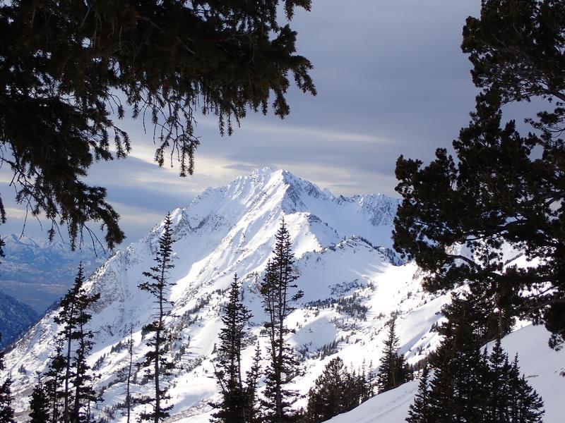
I rode down a S-SW aspect at 1500 just as cloud coverage and wind increased (photo 2). At this point, the sun was gone, and the snow on this aspect began the process of refreezing. Consequently, riding conditions were poor to fair.
Today's Observed Danger Rating
Moderate
Tomorrows Estimated Danger Rating
Considerable
Coordinates