

Observation Date
1/3/2021
Observer Name
Zimmerman-Wall/Nason
Region
Salt Lake » Little Cottonwood Canyon » Red Pine » Pink Pine
Location Name or Route
Pink Pine Ridge-Red Right Returning
Comments
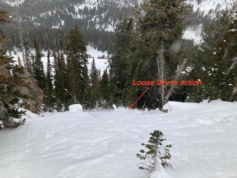
Storm arrived by sunrise-730 am-with lowering clouds, increasing light snowfall, light westerly winds. Temperatures were mild. The snow surface has lost cohesion in the last 48 hours and it was easy to initiate shallow (5cm) loose dry avalanches in the steep shots just off the Pink Pine Ridge into White Pine. These would entrain but not spread much wider than your skis and then lose steam as slope angle lessened. In sustained steep terrain (~35*) these may run further and could surprise a traveler.
Goal of the day was to determine how the slab is settling and gaining strength over the well-advertised weak layer in the bottom 1/3 of our snowpack. We did not experience any signs of cracking or collapsing on our tour up the ridge, or on the descent. We performed a test profile on the flanks of Red Right Returning, which is a large boulder field just below the ridge. The main shot starts at over 35* and lessens to around 28-30* in the middle. The far rider's left is much lower angle, but is guarded by some steep entryways through pines and aspen. Our profile on the 25* left flank revealed the aforementioned facets buried 12.11.2020 and the crust above. Small grain facets also exist above this crust. Of interest is also the layer of small buried Near Surface Facets from 12.22.2020. See profile for results and structure. Note this was an anomalously deep area with HS of 135cm.
Key Takeaway- the slab is stiffening and gaining more cohesion, but its variable thickness and elasticity differs greatly across terrain. In many places your boot penetration is full depth, but your skis only go through 10cm. Evidence of a soon to be insidious problem- if it ever snows like we know it can in the Wasatch. The good ol' Rutschblock test seemed appropriate given the evidence we have seen lately and from our additional profile tests. While the Near Surface Facets down 40cm only showed clean shears in Shovel Shear tests, we could not get propagation. Yet did observe propagation on the lower faceted layers.
Video
Today's Observed Danger Rating
Moderate
Tomorrows Estimated Danger Rating
None
Coordinates