Join us at our 2nd Annual Blizzard Ball

Forecast for the Salt Lake Area Mountains

Trent Meisenheimer
Issued by Trent Meisenheimer on
Thursday morning, December 17, 2020
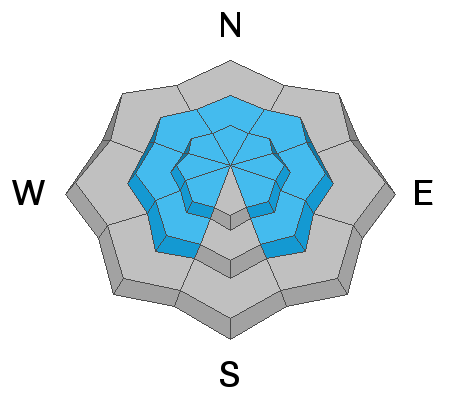
Today will be a day of RISING AVALANCHE DANGER and may even reach HIGH this afternoon with peak winds and snowfall.
As of now, the danger is CONSIDERABLE on all upper elevation steep wind loaded terrain. At mid-elevations, the avalanche danger will rise to CONSIDERABLE on steep slopes that face west through north through east. Any mid and upper elevation steep slope that harbors weak faceted snow should be approached with great caution.
Human triggered avalanches 12-18"+ deep are likely and may be triggered at a distance. Careful snowpack evaluation, cautious route-finding, and conservative decision-making are essential today.
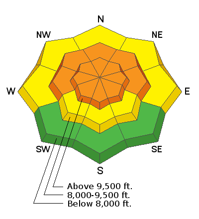
Low
Moderate
Considerable
High
Extreme
Learn how to read the forecast here
Avalanche Watch
THE AVALANCHE DANGER FOR THE MOUNTAINS OF NORTHERN AND CENTRAL UTAH, INCLUDING THE WASATCH RANGE...THE WESTERN UINTAS AND THE MANTI-SKYLINE PLATEAU WILL LIKELY RISE TO HIGH OVER THE NEXT SEVERAL DAYS.
Special Announcements
Supreme area of Alta Ski Area is now closed to uphill/downhill travel. The summer road to Catherine's Pass will remain open.
Weather and Snow
The National Weather Service has issued a Winter Weather Advisory for the mountains of northern Utah from 8:00 am this morning through Friday at 3:00 pm. As this storm approaches, we will increase southwest winds that are likely to peak early this morning with speeds of 15-25 mph gusting into the 30's and 40's across the upper elevation terrain.
Snowfall should begin around 11:00 am and will intensify by early afternoon as the frontal passage comes through northern Utah. Winds will veer to the northwest and decrease in speed early this evening. Snow densities will start in the 8-12% range this morning before the front moves through. We could see periods of heavy snowfall with peak intensities of 1-2" per hour. It's a short-lived storm, but all said and done, we could see 8-14" of new snow with roughly an inch of water by Friday afternoon.
Currently, the mountain temperatures are in the mid 20's °F across the map. Winds are blowing from the southwest at speeds of 10-15 mph, gusting into the 20's.
Recent Avalanches
Reports of collapsing and cracking within the snow have become the new normal, as many backcountry observers have noted in their observations. Reports of shallow 8-16" deep by 30-50' wide avalanches continue to trickle in as well. You can find all the observations HERE.
Ad
Avalanche Problem #1
Persistent Weak Layer
Type
Location
Likelihood
Size
Description
It's no secret, mid and upper elevation southwest, through north, through southeast facing slopes harbor weak faceted snow (weak layer). Wind, snow (water weight), and precipitation intensity are the variables that make the avalanche danger rise or decrease. Add any one of these variables to our current snowpack structure, and it will be no match for the weak snow below... Well, this storm has all three of these variables working in its favor, and I anticipate the avalanche danger to rise significantly this morning into early afternoon as we build a cohesive slab over our weak and unstable base.
These avalanches are not messed with and will be large enough to catch, carry, bury, and kill us. The best way to avoid this problem is to stick to low angle terrain (less than 30° degrees in steepness) with nothing steep above or adjacent to you. These are the conditions where we can trigger avalanches from a distance. Avoidance is key.
Avalanche Problem #2
Wind Drifted Snow
Type
Location
Likelihood
Size
Description
Southerly winds will peak mid-morning at speeds of 15-25 mph as the new snow begins to fall. Any slope receiving wind drifted snow will be suspect today. If the wind drifts snow onto slopes that harbor weak faceted snow, it will only complicate the above persistent weak layer problem and make the avalanche more likely to be triggered and make them larger in size. It's best to avoid any slope that is being loaded by the wind.
Avalanche Problem #3
New Snow
Type
Location
Likelihood
Size
Description
As the new snow begins to stack up, we could see new snow soft slabs and loose snow avalanches. The game-changer is the rate at which this new snow is forecasted. Over the past week, we've seen off and on again snowfall adding up to 12" of new snow with about an inch of water weight. This storm will bring that amount in twelve hours. The rapid rate is enough to cause the new snow to be unstable.
General Announcements
Please visit this website with information about Responsible Winter Recreation by the Utah Office of Outdoor Recreation.

This information does not apply to developed ski areas or highways where avalanche control is normally done. This forecast is from the U.S.D.A. Forest Service, which is solely responsible for its content. This forecast describes general avalanche conditions and local variations always occur.