Observation: Big Cottonwood Canyon

Observation Date
12/13/2020
Observer Name
B
Region
Salt Lake » Big Cottonwood Canyon
Location Name or Route
Upper Big Cottonwood Canyon
Weather
Sky
Overcast
Wind Direction
West
Wind Speed
Light
Weather Comments
Clear skies transitioned to Overcast by mid afternoon. Temperatures rebounded to above average figures with 8500 feet hitting upper 20's. Ridgetop winds at 10400 remained Light out of the W in the am and then veered to be more out of the WSW in the pm. No Wind Blown and or Transport observed.
Snow Characteristics
New Snow Depth
12"
New Snow Density
Low
Snow Surface Conditions
Powder
Wind Crust
Snow Characteristics Comments
Settled HST in Catherine's area was 30 cm, with Lower elevations out of Brighton more close to 17 cm. Wind scouring was observed in the exposed W through N facing Upper Elevation terrain. Settlement averages from 8000 to 10400 appeared to be at least 25 percent, and the Loose Dry Avalanche Problems that were Widespread on Saturday appeared to be less reactive today.
Moderate to Low Angle riding continues to offer the best turns. Our snowpack appears to be more like a mid-November pack than a mid-December pack, and cautious riding is important to avoid colliding with early season obstacles. Interestingly, the steeper lines skied today rode like the snowpack was inverted; and this appeared to be a result of carving down below an ambient crust that was near the pre-storm snow surface.
Red Flags
Red Flags
Recent Avalanches
Wind Loading
Poor Snowpack Structure
Red Flags Comments
See picture of Natural Avalanche in the Main Dog Lake Chute, and this was observed in the early morning hours. It appeared that it most likely released in the afternoon hours on Saturday. An obvious Wind Roll was observed as part of the Crown Face, and it was likely loaded and triggered during the periods of Moderate to Strong WNW Winds. Size appeared to 1.5. Of note, it appeared that there was similar Natural activity in the A-Frame Cliffs in the Rocky Points area, though there might have been human activity on Saturday that helped initiate this slide. See second picture.
Avalanche Problem #1
Problem
Wind Drifted Snow
Trend
Decreasing Danger
Problem #1 Comments
Still experiencing cracking in Isolated pockets of Wind Slab, though they were not as sensitive as on Saturday.
Avalanche Problem #2
Problem
Persistent Weak Layer
Trend
Increasing Danger
Problem #2 Comments
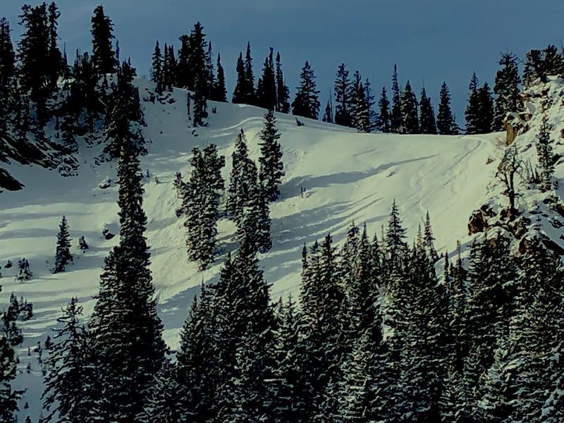
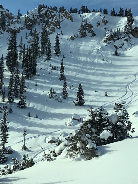
Hasty pits and Hand Shears continue to produce Very Easy Shears at the interface of the new snow with the NSF's at the top of the pre-storm snow surfaces. As reported by all, Widespread PWL's are on many aspects and elevations throughout the range. It appeared that this latest storm snow has not yet consolidated into much of a Slab, and it did not have enough SWE to become an issue in many locations. Of note, in the isolated areas where Wind Loading has helped develop Slab Structure, this issue exists.
Todays danger appeared to an isolated Moderate for potential Wind Slabs with a contributing factor of PWL's.
With a forecast for potentially at least another .5 of SWE and 30 cm of snow, the trend for this issue to increase in danger is possible. If this forecast verifies, the danger rating on Monday may rise to Considerable by mid morning.
Today's Observed Danger Rating
Moderate
Tomorrows Estimated Danger Rating
Considerable
Coordinates