Join us at our 2nd Annual Blizzard Ball

Forecast for the Salt Lake Area Mountains

Nikki Champion
Issued by Nikki Champion on
Monday morning, November 23, 2020
The avalanche danger is LOW and avalanches are unlikely.
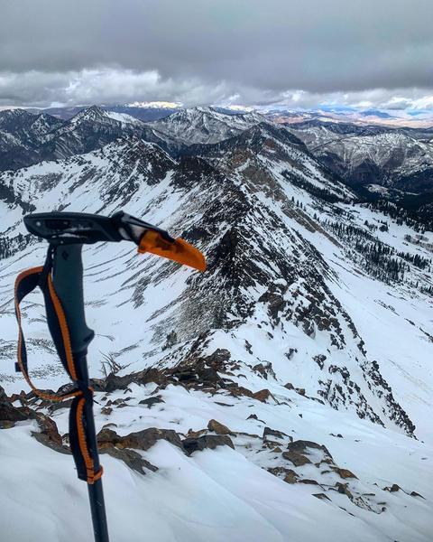
The biggest concerns are slide-for-life conditions on the slick crusts and getting injured in the shallow snowpack by hitting rocks or other obstacles.
Remember, a few inches of low-density snow will only disguise the firm conditions that lie below, continue to tread lightly.
Low
Moderate
Considerable
High
Extreme
Learn how to read the forecast here
Special Announcements
Please do everything possible to avoid getting hurt for yourself and the greater good. As you decide where and how to travel in the backcountry, consider adding just a little extra margin of safety.

Announcement: Please visit this website with information about Responsible Winter Recreation by the Utah Office of Outdoor Recreation.

If you missed the 13th Annual Utah Snow and Avalanche Workshop, the recordings are available for purchase from the UAC Store.
Weather and Snow
This morning, under mostly clear skies the mountain temperatures range from upper 20s F at trailheads to low 20s F at upper elevations. The winds are currently southwesterly, and lightly blowing 5-15 mph with gusts up to 30 mph at the upper ridgelines.
Today will bring a weak weather system through the area from late afternoon into the early evening. Temperatures should climb to the upper 20s F and low 30s F by midday, and then begin to drop throughout the afternoon. Winds will continue to be Southwesterly and gusting up to 25 mph at mid-elevations, and up to 40 mph at upper elevations.
This weak weather system will linger through the evening, ending by early tomorrow morning. If we are lucky we could pick up 2-6" of low-density snow from this system before we move into another brief period of high pressure. Another weak storm arrives for Thanksgiving.
The backcountry is full of a variety of snow surfaces right now, primarily firm crusts. While there is 1-2' of snow on the ground it has been hammered by the wind, sun, and thermal temperature changes. Beyond that, areas that have been getting full sun have been increasingly shallow. Remember, 2-6" of low-density snow will only thinly cover these dangerous and firm riding conditions, continue to ride with caution.
Recent Avalanches
No new avalanches were reported from the backcountry yesterday.
For recent observations from the backcountry, click HERE....or find them in the Observations and Avalanches tab in the Menu above.
Ad
Avalanche Problem #1
Normal Caution
Type
Location
Likelihood
Size
Description
The snow is generally stable and the danger is LOW. Pro observer Mark White summited Mount Superior on Thursday and reported the biggest hazard being slide-for-life conditions on nearly all aspects.
Slide for life conditions are conditions where one falls in steep terrain and unable to arrest on the slick crust below. Axes, whippets, crampons, etc can be helpful in these conditions. (Sorta gives a hint to the riding conditions, eh?)
With shallow early-season conditions, getting caught in even a small avalanche or sliding on a frozen slope could have dire consequences with so many exposed hazards.
Additional Information
Forecaster's Corner:
With clear skies and cold temperatures, the surface snow on the north side of the compass begins to become weak and faceted and generally lose cohesion (see Mark White video below). In the short term, this means you can buy a soft turn here or there, but in the long term it becomes a very real sliding surface for future avalanches whenever we see the next significant storms. At this point, the snow surfaces are quite variable, but it will be something to keep an eye on in the coming days (or weeks).
For the layperson, remember that ingredients for an avalanche often involve strong cohesive snow sitting above weak, sugary snow. Sugary faceted (angular) snow below.
General Announcements
This information does not apply to developed ski areas or highways where avalanche control is normally done. This forecast is from the U.S.D.A. Forest Service, which is solely responsible for its content. This forecast describes general avalanche conditions and local variations always occur.