Join us at our 2nd Annual Blizzard Ball

Forecast for the Salt Lake Area Mountains

Trent Meisenheimer
Issued by Trent Meisenheimer on
Tuesday morning, November 17, 2020
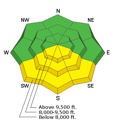
The avalanche danger will rise to MODERATE today on south-facing slopes receiving direct sunshine where loose wet avalanches are possible. The avalanche danger is LOW on all other slopes.
Low
Moderate
Considerable
High
Extreme
Learn how to read the forecast here
Special Announcements
Please do everything possible to avoid getting hurt for yourself and for the greater good. As you decide where and how to travel in the backcountry, consider adding just a little extra margin of safety.
Weather and Snow
As two troughs pass us to the north, we will see plenty of sunshine with increasing southerly winds today and through tomorrow. Currently, southerly winds are blowing 20-30 mph, gusting into the 30's & 40's across the upper elevation ridgelines. The forecast reports these southerly winds will increase throughout the day, bumping the speeds to 30-40 mph gusting to 80 mph.
Current mountain temperatures at the mid and upper elevations (9,000'-10,000') are reading 40°- 45° F with no overnight refreeze. Lower elevation (7,500') temperatures are below freezing and reading 25°F. Now that's a temperature inversion! Temperatures are forecasted to rise into the mid 50's °F at 9,000' this afternoon. Who brought the hairdryer to the powder show???
The riding and turning conditions have deteriorated over the past few days, with sun and wind crusts on many aspects and elevations throughout the range. Your best bet for soft, dense powder turns will be on the mid and upper elevation sun and wind-protected terrain.
Recent Avalanches
Some small wet-loose avalanches (rollerballs) were noted by backcountry travelers on the sunny aspects. All backcountry observations can be found HERE.
Ad
Avalanche Problem #1
Wet Snow
Type
Location
Likelihood
Size
Description
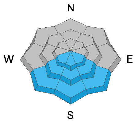
With sunny skies and temperatures expected to climb into the 40's & 50's °F today, we can expect the southerly facing terrain to warm and possibly become wet enough to produce wet loose avalanches. This should be a predictable avalanche problem today - once you see rollerballs cascading off the steeper sunlit terrain, it's time to change your aspect.
The wild card will be the wind, and perhaps it keeps the snow surface just cold enough to not produce any wet activity today.
Avalanche Problem #2
Wind Drifted Snow
Type
Location
Likelihood
Size
Description
As the southerly winds continue to increase throughout the day, they will try and strip and deposit whatever snow is left on those upper elevation ridgelines. I am always amazed that the wind can find snow to drift, especially when the mountains have very little snow left to transport.
These new drifts of windblown snow will be shallow and not much of a problem unless you find yourself in very exposed terrain where even a small avalanche can knock you off your feet. The consequences of avalanches drastically change, depending on the terrain you are in.
General Announcements
This information does not apply to developed ski areas or highways where avalanche control is normally done. This forecast is from the U.S.D.A. Forest Service, which is solely responsible for its content. This forecast describes general avalanche conditions and local variations always occur.