


Observation Date
11/15/2020
Observer Name
Greg Gagne
Region
Salt Lake » Little Cottonwood Canyon
Location Name or Route
Upper LCC
Comments
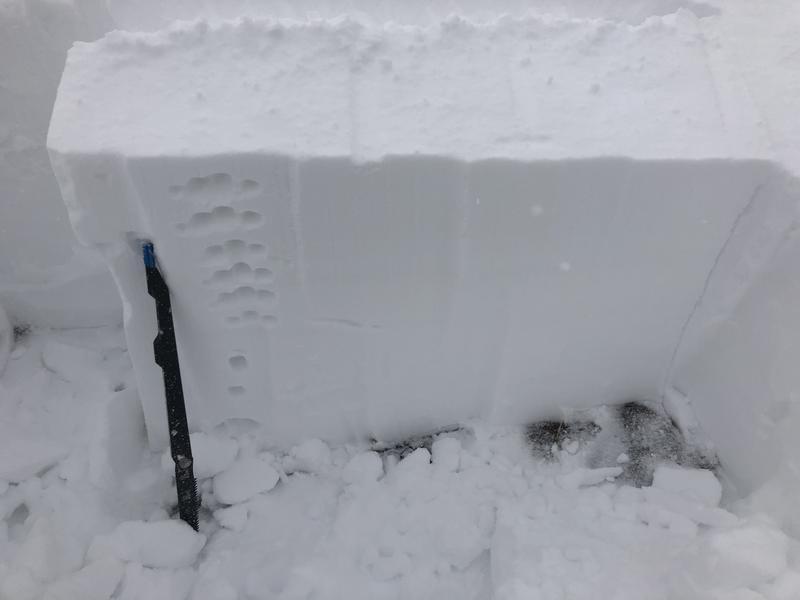
Overall the snowpack looks very stable and we are off to a great start to the season, with decent coverage and supportable travel and riding conditions. Dug several pits between 9 and 10.5 K today and the low-density snow from earlier this past week is quickly gaining strength. This was a layer of concern as the Friday/Saturday storm and wind-driven snow would be quickly putting a load on top of it, but the strong winds, dense storm snow, and warm temperatures have allowed the entire snowpack to gain strength with no obvious weak layers.
Photo below shows the right-side-up snowpack, with the low-density snow from earlier this week at midpack. The snow down near the ground is damp and rounding.
Overall Moderate hazard that is trending towards Low.
Today's Observed Danger Rating
Moderate
Tomorrows Estimated Danger Rating
Moderate
Coordinates