Observation Date
4/14/2020
Observer Name
Ted Scroggin
Region
Uintas
Location Name or Route
Upper Whitney Basin
Weather
Sky
Few
Wind Direction
Northwest
Wind Speed
Moderate
Weather Comments
Another chilly start to the day with single digits this morning and a slight northwest breeze. A few clouds throughout the day, quite cold on the ridge tops this afternoon and a few new inches of snow from the Sunday/Monday storm.
Snow Characteristics
New Snow Depth
4"
New Snow Density
Medium
Snow Surface Conditions
Powder
Wind Crust
Melt-Freeze Crust
Snow Characteristics Comments
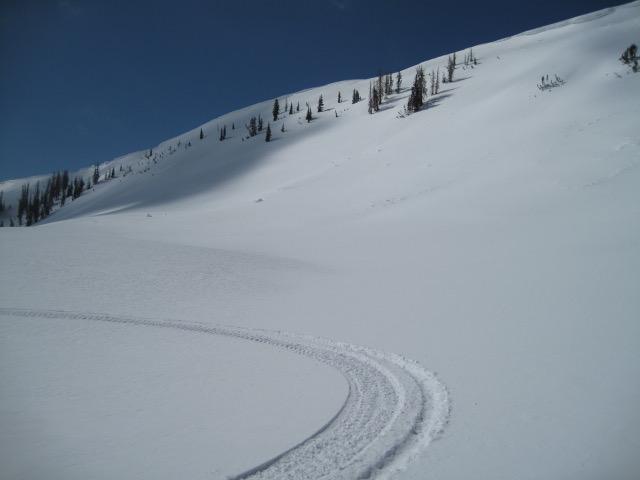
Around an inch of new snow at the trail head this morning and about 4-5" in Whitney Basin, this all coming from the small Sunday/Monday storm. Just a few inches of snow can sure go along way to help improve the spring riding conditions. Slopes all around the compass are pretty well locked up right now with hard supportable snow, but the recent snow made for some nice riding and turning today. Temperatures stayed cool today and I did not observe any wet snow issues.
Red Flags
Red Flags Comments
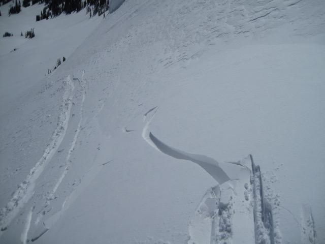
A few minor wind drifts that would crack today from recent snow and wind, but these did not change the hazard all that much. These were pretty well bonded to the firm snow underneath and did not pose a real problem. Some of these could trip a rider up in very steep and windy terrain and these might become more of an issue with the upcoming storm the next few days.
Avalanche Problem #1
Problem
Normal Caution
Trend
Increasing Danger
Problem #1 Comments
A person might find a fresh wind drift along the higher exposed ridge lines that will crack up to 10" deep, but I was not finding these very wide or connected. In steep terrain these could be more of a problem with the hard slick snow underneath.
Comments
You might find a wind drift or two out there from the recent snow and wind and these did not create a real concern unless you might be in steep terrain with hard slick snow underneath these drifts.
A few new inches of snow the last couple of days and it went a long way to improve the spring riding and turning conditions.
The snow coverage in the Whitney area looks good right now and should help the water year.
Generally a low hazard today and might see the conditions change with a storm forecasted this week.
Today's Observed Danger Rating
Low
Tomorrows Estimated Danger Rating
Low
Coordinates