Observation: Red Pine Gulch

Observation Date
4/3/2020
Observer Name
Wilson, Hardesty
Region
Salt Lake » Little Cottonwood Canyon » Red Pine
Location Name or Route
Red Pine
Weather
Sky
Scattered
Wind Direction
Southwest
Weather Comments
With temps in the high teens and low 20's if felt like a return to winter. Sky was mostly clear in the morning, with increasing cover mid-afternoon. Winds started light but picked-up on the ridge lines in the afternoon.
Snow Characteristics
New Snow Depth
4"
New Snow Density
High
Snow Surface Conditions
Powder
Dense Loose
Damp
Snow Characteristics Comments
Upper elevation north aspects still have soft, consistent, deep-enough snow for great turning. the April 2nd storm delivered only an inch to the low elevations but closer to 4 inches in the upper bowl of Redpine. Near surface faceting is already under-way, and should continue with another clear night ahead.
Avalanche Problem #1
Problem
Wind Drifted Snow
Trend
Increasing Danger
Problem #1 Comments
Although relatively little snow was transported across the ridge line today, the thin wind slab landed on faceting snow and broke/slid easily. With another night of faceting and increasing winds tomorrow evening, this might be a bigger concern for Sunday.
Comments
Photos
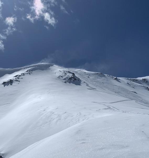
Snow blowing across the ridge
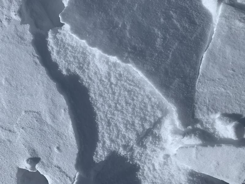
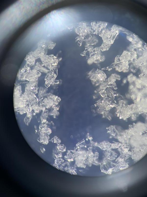
Breaking and sliding easily (in teeny, tiny, not-to-worry about yet, sizes)
because it landed on a faceting surface.
Plenty of wet activity from Tuesday to look at, but in our terrain the wet "activity" was limited to roller balls. Snow stayed cool for the most part.
A blessing of sorts from our snow-shoe neighbors; stay safe, stay happy.
Today's Observed Danger Rating
Low
Tomorrows Estimated Danger Rating
None
Coordinates