

Observation Date
4/3/2020
Observer Name
Derek DeBruin
Region
Ogden » Ben Lomond » Cutler Ridge
Location Name or Route
Ben Lomond, Cutler Ridge
Comments
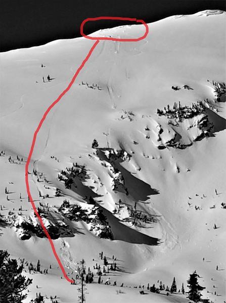
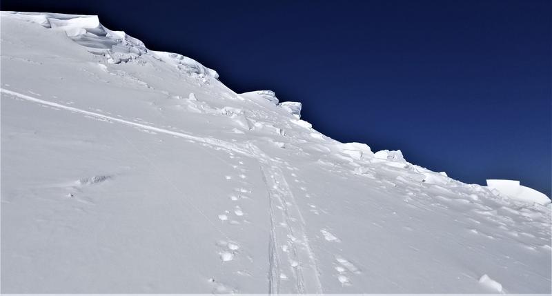
Cornices have regrown since a week ago, with new suspects along the Chilly Peak ridgeline as well as around the Ben Lomond summit. There was a recent cornice generated avalanche (probably yesterday, 20200402, or perhaps the day before?). The resulting load kicked off a wet slide that continued all the way down the Cutler Headwall, jumping a cliff on the way. Strong caution is advsised anywhere near these cornices, whether above or below, particularly with the clear skies and warmer temps in the forecast tomorrow (20200404). Pictured below is the full track of the the cornice generated avalanche (first picture) as well as a closer shot near the skin track (second picture).
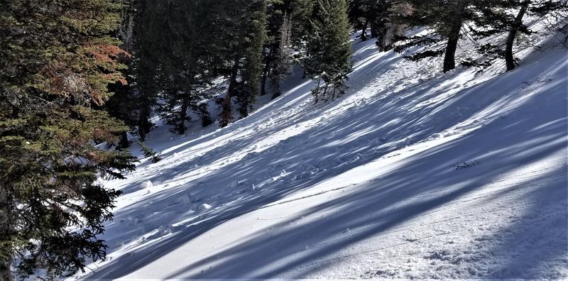
Wet avalanches will likely remain a consistent hazard with diurnal heating, solar heating, or simply the general increase in temperatures as we proceed into spring. There was one recent full track wet slide that occurred before today that ran the vertical distance of the headwall below the Ben Lomond summit. There were also the typical wet slides on the Willard side of the headwall, additional wet activity on Island Peak, and a crop of new small wet slides in Bailey's. Of particular interest was the proliferation of leftover rollerballs on the steeper (>30 degrees or so) northerly slopes at the mid elevations. As the sun is tracking higher in the sky, slopes that are normally sun and wind sheltered throughout the winter are seeing sunshine as well warmer temperatures. The photo below is a NNE facing slope around 7600ft below a 35 degree rollover where much of this debris originated. Avoiding these chunks is just one more reason to favor the lower angle terrain.
Today's Observed Danger Rating
Low
Tomorrows Estimated Danger Rating
None