Observation: Grizzly Gulch

Observation Date
3/26/2020
Observer Name
Hardesty and Wilson
Region
Salt Lake » Little Cottonwood Canyon » Grizzly Gulch
Location Name or Route
Grizzly Gulch
Weather
Sky
Overcast
Precipitation
Light Snowfall
Wind Direction
Southwest
Wind Speed
Calm
Weather Comments
Cool, calm, lightly snowing.
Snow Characteristics
New Snow Depth
16"
New Snow Density
Medium
Snow Surface Conditions
Powder
Snow Characteristics Comments
Roughly 50cm settled storm snow. Filtered sun able to wriggle through the clouds a couple times which made south and southwest aspects a bit heavier.
Red Flags
Red Flags
Recent Avalanches
Heavy Snowfall
Wind Loading
Red Flags Comments
Very minor low volume slow moving sluffs initiated on very steep slopes. Pockety wind drifts also triggered just lee of ridgelines. See below. Stability increased during the day; likely Considerable this morning...stabilizing toward Moderate by the afternoon.
Avalanche Problem #1
Problem
Wind Drifted Snow
Trend
Decreasing Danger
Problem #1 Comments
Moderate to strong overnight southwest winds formed drifts camouflaged by early morning storm snow. We noted one that had been triggered at the top of East Bowl of Silver (10,400' WNW) and we went on to trigger another piece of it perhaps 50cm deep and another 40' wide (photo). Seemed very localized to higher elevations. Pic below.
Avalanche Problem #2
Problem
New Snow
Trend
Decreasing Danger
Problem #2 Comments
New snow instabilities only noted with snow tests (see video)...with shear planes in the 50cm storm snow down about 30cm likely at the interface mid-storm. Will heal soon.
Snow bonded well to old snow surfaces everywhere (except where outlined below).
Comments
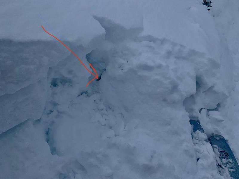
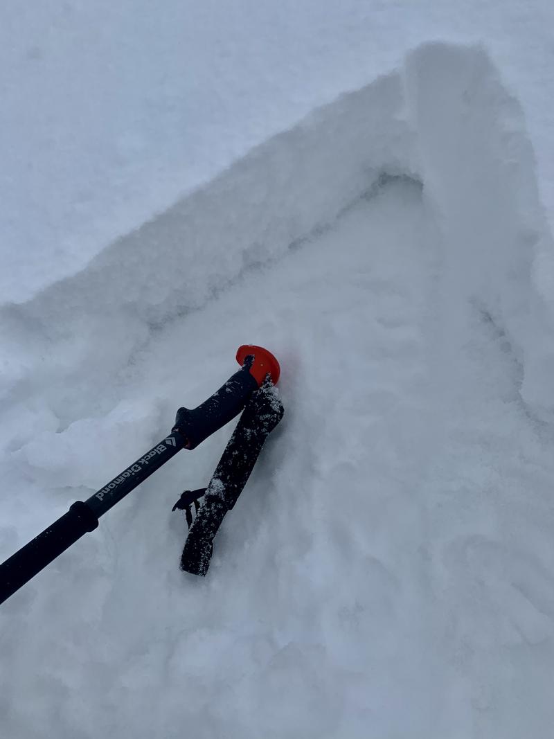
The original wind slab (1st pic) crown 'cracked' down another 4" but did not release on this a layer of small grained facets above last weekend's sun crust. When we triggered the skier's left portion, I noted an interesting crack on the bed surface 10' wide. Investigation revealed this too was the small grained facets with 3" 4F+ "slab" above. Seems isolated but interesting layering all the same and may be perhaps more of an issue along much higher elevations where wind loading would be even more of a factor. Did not see this layering on northeast or south...
Bottom Line: would expect new snow and wind slabs to stabilize soon; perhaps lingering wind slabs along highest elevations for Friday; key will be looking for if/when the sun comes out as snow conditions and avalanche conditions turn on a dime in spring.
Today's Observed Danger Rating
Moderate
Tomorrows Estimated Danger Rating
None