

Observation Date
3/25/2020
Observer Name
Mark Staples
Region
Salt Lake » Big Cottonwood Canyon » Mill D North
Location Name or Route
Mill D North to Little Water Peak
Comments
Snow on south aspects and below 9000 seemed mostly well bonded to the crust underneath.
Above 9000 or 9500 feet, it is a different story, especially on more northerly aspects. I suspect similar conditions on easterly aspects at upper elevations too. See this avalanche that I triggered.
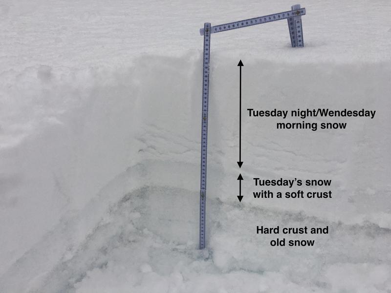
Danger rating for today were spot on. Low at low elevations. Moderate at mid elevations. Considerable at upper elevations. Tomorrow's danger will depend on how much snow we get tonight.
Today's Observed Danger Rating
None
Tomorrows Estimated Danger Rating
None
Coordinates