UDOT PLANNED AVALANCHE CLOSURES!!

Observation: Moab

Observation Date
3/22/2020
Observer Name
Nauman, Quinn, Wilson, Howell
Region
Moab
Location Name or Route
West Face in Talking Mtn
Snow Characteristics
Snow Surface Conditions
Powder
Dense Loose
Wind Crust
Red Flags
Red Flags
Recent Avalanches
Wind Loading
Rapid Warming
Red Flags Comments
Things have been active in the La Sals on north faces with large avalanches from wind loading stepping down to weak layers 2-4' deep. We have had a lot of new snow and wind redistribution over the last 2 weeks. We stuck to south and west faces today and things were not as freaky as the northerly aspects. We skied a low angle south face and did have a CT13 clean shear at ~37 cm below the surface just below the first crust we found. The south faces also got really hot and started to produce numerous roller balls and some small wet slides. We were focused on west faces and found the snowpack pretty strong and supportable in our pit and in touring. Had no result on a CT or ECT test and felt good about the snowpack. However, several shallow, but 50-100' wide wet slides did get triggered right below cliffs in steep west facing slopes due to rapid heating. However, we found some lower angle W-SW faces with no cliff faces to ski and it was good hot powder. There will probably be a freeze crust in these areas tomorrow.
Avalanche Problem #1
Problem
Persistent Weak Layer
Trend
Decreasing Danger
Problem #1 Comments
The combination of weak faceted snow in more shallow areas of snow with new storm snow and wind loading have produced some large recent avalanches. North faces are suspect until proven otherwise.
Avalanche Problem #2
Problem
Wet Snow
Trend
Same
Problem #2 Comments
The hot March sun has really been heating up this new snow. We saw several wet slides today on south faces and from the bases of cliffs on west faces. Going to have to watch refreezes and be careful late in the day with this problem on sunny days moving forward.
Snow Profile
Aspect
West
Slope Angle
27°
Comments
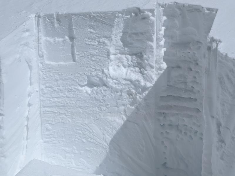
Snow pit with evident set of old freeze thaw crusts under the last few storms.
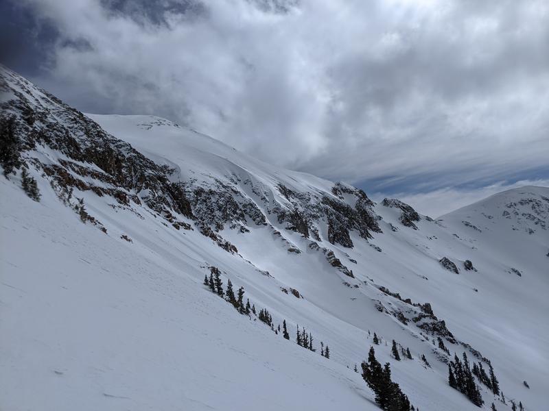
Wet slides coming out from cliff bases on west faces.
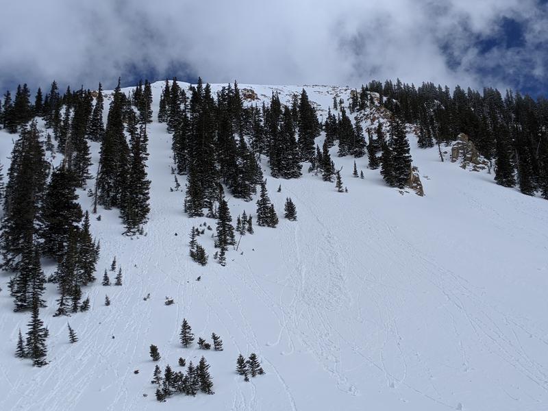
Wet slide on a south face
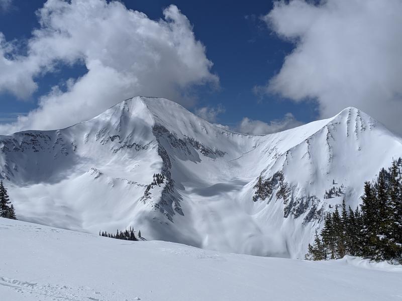
The big slide in Red Snow that got loaded by wind yesterday evening and broke down to a persistent weak layer ~4' deep.
Today's Observed Danger Rating
Considerable
Tomorrows Estimated Danger Rating
Considerable
Coordinates